ولاية ينقل


Wilayat Of Yanqul


ولاية ينقل 


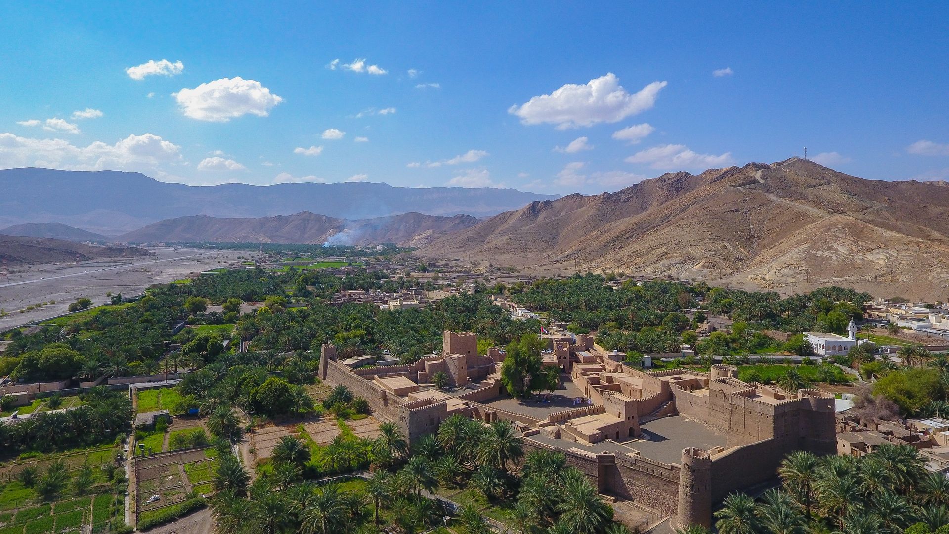
تقع ولاية ينقل في محافظة الظاهرة وهي إحدى ولايات المحافظة الثلاث فهي تقع في الجزء الشمالي من المحافظة وتتصل بكل من ولاية عبري من جهة الشرق والجنوب وولاية ضنك من جهة الغرب وولاية صُحار في محافظة الباطنة من جهة الشمال.

تقدر مساحة الولاية بحوالي 3100 كيلومتر مربع. وتشكل ما نسبته 9% من مساحة المحافظة.

يبلغ عدد القرى والمناطق التابعة للولاية حوالي (78) قرية وبلدة أشهرها (مركز المدينة، ويشمل: العلو - الصوادر - البويب -  المدام - الصفري -كرش - الجغنة - الخابورة - حيل المناذرة – العقدة - بلدة صيع - بلدة فلج السديرين - قرية البويردة - قرية الروضة - بلدة المري - بلدة غضياء - بلدة الخبيب - بلدة طوي النوامية - قرية الشوعية - قرية المعيدن - بلدة الوقبة - حيل الخنابشة - قرية المسرة -  قرية وال - وادي العرشي - وادي الحريم -  بلدة بيحاء).

حظيت ولاية ينقل كسائر مدن وولايات السلطنة بفيض وفير من معطيات النهضة المباركة تحت ظل القيادة الحكيمة لمولانا حضرة صاحب الجلالة السلطان هيثم بن طارق المعظم - حفظه الله ورعاه -  فانتشرت مدارس التعليم لتغطي مظلتها كافة القرى والمناطق بالولاية البعيدة منها والقريبة، تخرج منها العديد من الكوادر في شتى مناحي العلم وتقلد بعضهم مناصب قيادية ليشاركوا جميعا في مسيرة الخير والعطاء، كما نالت الولاية نصيبها من الخدمات الصحية من خلال المستشفيات والمراكز والمجمعات الصحية،هذا بالإضافة إلى شبكات الطرق ومشاريع الكهرباء والمياه التي أصبحت واقع ملموس ظاهر للعيان، ناهيك عن الخدمات الأخرى كخدمات البريد ومراكز التنمية الزراعية التي حظيت بها الولاية.

ولاية ينقل كانت همزة الوصل في الماضي وحتى الآن بين محافظة الباطنة والظاهرة.. وكانت هي المكان الذي تتمركز عنده قوافل البضائع المسافرة من ساحل الباطنة إلى محافظتي الظاهرة والداخلية، هناك تتوقف القوافل، وتترك حمولتها لتحملها قوافل أخرى تواصل المسيرة الطويلة ولكونها مكان التجميع أو مكان (نقل) البضائع أخذت صفتها وتحولت الصفة إلى الاسم وصار المكان يعرف بـ {ينقل}.

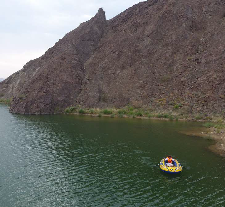
جبل الحوراء: هو شعار ولاية ينقل ويبلغ ارتفاعه أكثر من 1700 متر عن سطح البحر وهو أكبر جبل بالولاية ويقع الجزء الأكبر منه في بلدة الصوادر والتي تعد مركز للولاية، ويوجد في جبل الحوراء مجموعة متنوعة من الطيور ومن الثدييات لا سيما الثعالب والأرانب البرية، وتتواجد في العديد من أجزاءه من الأشجار سلم (شجر) والسمر والسدر والغاف.

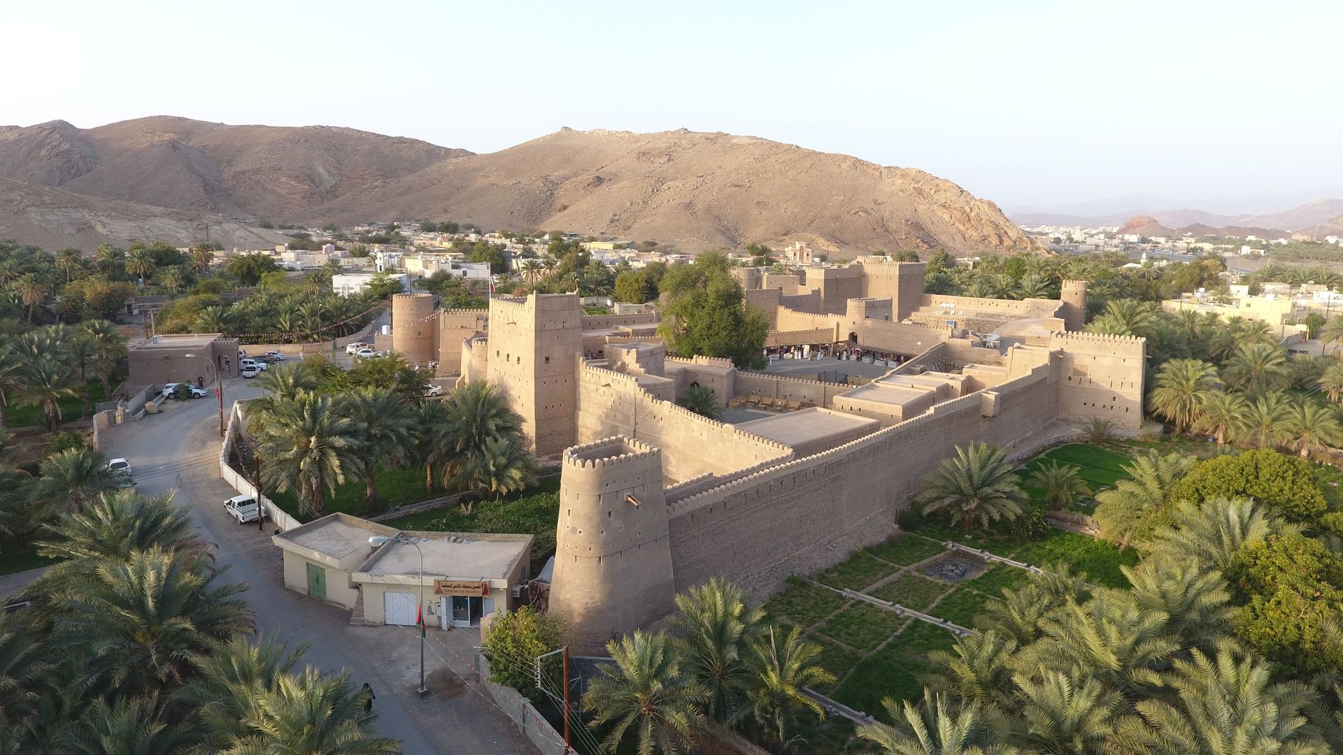
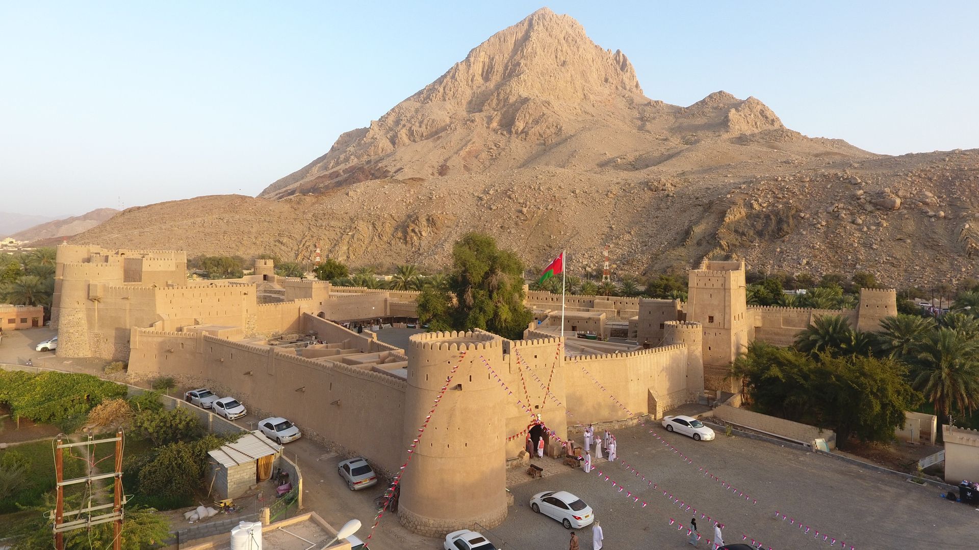
حصن حديقة (ينقل): يوجد به الكثير من الرسومات والكتابات ويوجد أعلى الحصن وبالتحديد على قمة الجبل المجاور بئر زينت جدرانه ببعض الرسومات الأثرية.

الأفلاج: تزخر الولاية بمنظومة كبيرة من الأفلاج أعتمد عليها العماني اعتمادا كلياً منذُ القدم في ممارسة النشاط الزراعي حيث وصل الإنتاج إلى حد الاكتفاء الذاتي. وقد بلغ عدد الأفلاج بالولايــة (26) فلج عدي و(46) فلج غيلي، ويوجد ببلدة ينقل منها عــدد (5) أفلاج (فلج العين يعد أكبر أفلاج الولاية من حيث منسوب المياه ثم فلج العلو وفلج المحيدث وفلج الخابورة وفلج حيل المناذرة) بالإضافة إلى العديد من الافلاج بمختلف قرى وبلدات الولاية.

المواقع الاثرية بالمحافظة 

المواقع الأثرية


حصن عبري                  قلعة السليف و حارة السليف             حارة الرمل

حصن العينين                موقع بات الاثري                            حصن العراقي

حصن الاسود                 حصن بيت المراح                           حارة الشعبانية

بلدة الوقبة                    حصن المنيخ                                  حارة المرقوع 

حصن بزيلي                  سوق صبيخا


    حصن عبري


يقع حصن عبري وسط مدينة عبري ملاصقا لسوقها القديم حيث يعود تاريخ بنائه إلى ما يقارب 400 سنة. قام النباهنة بتأسيس هذا الحصن المنيع وأكمل بناءه الشيخ خاطر بن عامر بن راشد اليعقوبي. للحصن عدة مداخل وبوابات أشهرها صباح السنسلة ومدخل آخر يسمى صباح الحصن والذي يعد المدخل الرئيسي للحصن وصباح الوسطي وهو المستخدم للبرزة وللحصن جامع كبير لا زالت تؤدى فيه صلاة الجمعة والصلوات الأخرى، يتميز الحصن بنقوشه التاريخية وآثاره القديمة، للحصن 3 أبراج هي: برج الصرم وبرج الغرابية وبرج صباح السنسلة.


     قلعة وحارة السليف


بنيت القلعة في عهد دولة اليعاربة وشيدها الامام سلطان بن سيف اليعربي في عام 1718ميلادية أي منذ 300عام على سفح جبل شنبوه الذي يطل على وادي السليف ويتميز حصنها بسوره الكبير الذي يحيط بها من كل الجوانب وابراجه السبعة وأشهرها برج الريح وتتميز ببيوتها الأثرية القديمة والبالغة 110 بيوت وبسوقها الأثري وبزخرفتها التي تجسد فنون عمارة العمانية وتبعد بلدة السليف عن مركز ولاية عبري مسافة خمسة كيلومترات وهي مدينة تتمتع بمقومات تاريخية وطبيعية وقد حظيت بالعديد من المنجزات التي زادتها جمالا ورونقا، واشتهرت بلدة السليف منذ القدم بالنخيل وبمختلف المحاصيل الزراعية.

حارة السليف تقع على الحافة الجنوبية للممر الشرقي للواحة ، فوق جرف منحدر بارز يمنحها مشهدا يشرف على الطرق الشرقية. ويبدو أن الحارة قد ظهرت فيها الحياة بداية بصفتها موقعا دفاعيا يتحكم في الممر المؤدي إلى عبري من الشرق.

و شهدت حارة السليف اختلافات في تعدادها السكاني من موسم لآخر ، إذ موسم حصاد التمور يقطن معظم السكان في بساتين النخيل والأراضي الزراعية ولا يعودون إلى الحارة نفسها إلا بعد انتهاء الحصاد.

الحارة قد بنيت على سفح جبل شنبوه مطلا على وادي السليف ، وذلك في عهد الأمام اليعربي , سلطان بن سيف الثاني (1123 – 1131 ﮪ \ 1711 – 1718- 19 م). ونظرا للأهمية التي يشكلها هذا الموضع بصفة منفذا إلى واحة عبري ، فمن المعقول وجود برج مراقبة أو قاعدة دفاعية قبل الحصن على التلة مطلة على الوادي (وكلاهما كان يعرف بأسم شنبوه) .


     حارة الرمل


حارة الرمل واحدة من الحارات الأثرية، يعود تاريخ بنائها لأكثر ‏من 300 عام وسط مدينة عبري على سفح وتلال جبل الرمل.


     حصن العينين


يقع حصن العينين على طول الطريق الرئيسي الواصل بين عبري والرستاق شمال عبري. ويجسد فن وروعة هندسة البناء المعمارية العمانية.


    موقع بات الاثري


تقع المواقع التاريخية في بات والخطم والعين بمحافظة الظاهرة ولاية عبري، وتعتبر من المواقع الأثرية والتاريخية التي يعود تاريخها إلى القرن الثالث قبل الميلاد وتقع إلى الشرق من عبري. ويعتبر ثاني موقع يتم إدراجه ضمن قائمة التراث العالمي في عمان في عام 1988.

والموقع عبارة عن قبور من طراز أم النار في الجزء الجنوبي، وفي الجزء الشمالي قبور خلايا النحل التي ترجع إلى الألف الثالث قبل الميلاد وهي تشبه في بنائها مدافن فترة حفيت، كما تم الكشف عن مقبرة احتوت على 100 مدفن مبنية من الحجارة ويبدو فيها التطور من مدافن خلايا النحل إلى مدافن فترة أم النار، فقد كان مدفن خلية النحل يضم ما بين مدفنين إلى خمسة مدافن.

ويحوي موقع بات على 6 مباني حجرية ضخمة دائرية الشكل تتوزع في الموقع وفي قرية بات ويتوسط غالبيتها بئر ماء وقد أحيط عدد منها بخندق كبرج الرجوم وبرج (1156) وألحق بجميع هذه المباني غرف مبنية بالطين على أساسات حجرية. وقد بنيت هذه المباني في فترات مختلفة يعود أقدمها الى حقبة حفيت (3200 -2700 قبل الميلاد) كبرج الخطم وبرج الخفا.


     حصن العراقي


يقع حصن العراقي وسط بلدة العراقي، وبه برجان هما: برج الجص وبرج الطين، وتوجد به عدة غرف ومخازن، وثلاثة آبار للماء، والحصن مستطيل الشكل، يتكون من طابقين. استخدم في بناءه الحصى والطين والجص والصاروج، وتقع بداخل الحصن بيوت أثرية، يوجد بها غرف للخدمات، وسبلة للضيافة، ولهذه البيوت باب خاص جهة الشرق يسمى باب (الراوية) يؤدي إلى الفلج.


    حصن الاسود


يقع هذا الحصن في مقنيات في داد خصيب على الحافة الشرقية لاحد سهول الوادي بين طيات الجبال ويرجع تاريخ بنائه إلى العام 972 هـ وهو حصن منيع مرتفع يضم أربعة أبراج هي : برج الريح-برج المراقبة والمطامر- الصباح- وبرج سليمان.

وكان يهيمن على المنطقة باسرها و هو الحصن الاسود الذي يقع على نتوء صخري عال تنتشر بمحاذاة أقدامه بساتين النخيل .وثمة طريقاً متعرجاً واضح المعالم ومسوراً في بعض اجزائه يفضي إلى المصطية المواجهة للمدخل المقنطر قرب البرج الغربي، ويوجد في الجانب الشمالي الشرقي من المصطبة منحدر راسي يصل إلى مستوى الارض المنخفضة مما يجعل الطريق المؤدي إلى المدخل الوحيد ضيقاً ويجعل من الصعب مهاجمته.


    حصن بيت المراح


يقع في قلب وادي ينقل في حارة الحصن في الجانب الشمالي الشرقي لجبل حورة ينقل ويحده من الجنوب جبل خطيم. اختلفت المصادر التاريخية في تأريخ بنائه ، فيذكر أحدها بأنه بني قبل الإسلام ، ويرجح مصدر ثاني أنه بني في القرن الحادي عشر الهجري ( القرن السابع عشر الميلادي ) بينما يذكر مصدر ثالث أنه بني على يد مخزوم بن فلاح النبهاني في بداية عهد النباهنة في عمان .بني الحصن بالطين والحجارة وشرعت وزارة التراث والثقافة في ترميمه عام 2002م بالصاروج. يحيط بالحصن مزارع أشجار النخيل ويقع على مقربة من بقايا قرية مهجورة ويعود تاريخ بنائه إلى القرن السابع عشر. وتحيط بجدران الحصن سلسلة كبيرة من المباني، من بينها مسجد بُني على الطراز التقليدي.


    حارة الشعبانية .


تعد هذه الحارة من اكبر الحارات في ولاية ينقل بل الأهم فيها فهي تجمع اكبر عدد من الناس آنذاك حيث تتكون هذه الحارة من بيوت أثرية قديمة سكنها الأهالي وظلت تستخدم إلى عهد قريب. يقول الوالد حميد بن سيف العلوي إن بيوت الحارة القديمة بنيت بالطين ظلت مقاومة للأمطار ومن سعف النخيل وجذوع النخيل وحتى الأبواب التي تصنع من شجرة السدر بأيد عمانية الى سنوات قريبة ومازالت بعضها، كانت الحياة في ذلك الزمان في الحارة القديمة حيث يلتقي الأهالي صباحا مع بعضهم ويتناولون القهوة العمانية وهي عادة معروفة لديهم منذ القدم فميزة الحارة انها تجمع الجميع وكأنهم أسرة واحدة على الرغم من تداخل البيوت مع بعضها البعض وتجمع الأهالي في مكان الا ان ذلك لم يقف حائلا أمام تعاون أبناء الحارة وهذه ميزة الحارة العمانية.


     بلدة الوقبة


تعد "بلدة الوقبة" بولاية ينقل بمحافظة الظاهرة من البلدات والقرى الجميلة بالولاية لما تتمتع به من مقومات سياحية جذابة وتبعد البلدة عن مركز الولاية حوالي (38) كيلومتراً.

وتقع البلدة بين عدد من الجبال الشامخة ضمن سلسلة جبال الحجر الغربي وهي ذات طبيعة جبلية حيث تربط محافظة الظاهرة بعدد من المحافظات الاخرى وميناء صحار الصناعي الى جانب عدد من الولايات والقرى والمناطق.

وتعد "بلدة الوقبة" من المحطات السياحية الجميلة حيث يوجد بها عدد من الأودية التي تشهد حركة سياحية نشطة خاصة مع جريانها حيث تشكل مكاناً ملائماً للراحة والاستجمام كوادي بيحا ووادي العرشي كما تنتشر الكهوف الجبلية في قمم الجبال التي تستهوي الكثيرين من محبي التسلق بالإضافة الى وجود منابع المياه الصافية التي تتكون بعد جريان الأودية. وتتميز "بلدة الوقبة" ايضا بوجود العديد من المواقع التراثية والمعالم الحضارية كالبيوت القديمة التي مازالت شامخة حتى اليوم بروعتها وبراعة هندستها العمانية الجميلة.


     حصن المنيخ


يعتبر حصن المنيخ من المواقع التراثية في ولاية ضنك حيث يبلغ طول الحصن (40) مترا وعرضه يتراوح ما بين (30- 35) مترا وبمساحة إجمالية تصل إلى (1200) مترا مربع.

يتكون الحصن من ثلاثة أبراج والصباح الرئيسي له ومجلس عام ومجموعة من الغرف والمخازن بالإضافة إلى مواقف للزوار وتجميل المنطقة المحيطة بالحصن. انتهت وزارة التراث والثقافة ممثلة بدائرة الترميم والصيانة بالمديرية العامة للآثار والمتاحف من ترميم حصن المنيخ بولاية ضنك بمحافظة الظاهرة. وكانت أعمال الترميم قد بدأت في شهر أغسطس 2013م حيث تمت على عدة مراحل تمثلت في مرحلة التوثيق والتصوير وأعمال التنظيف والتدعيم ومن ثم إعداد الخرائط الخاصة بأعمال الترميم مع مراعاة الحفاظ على النمط العمراني الذي شيد به الحصن واستخدام مواد البناء التقليدية كالطين والصاروج والحجارة. وتم تزويد الحصن بكافة الخدمات الضرورية كالكهرباء وأنظمة التكييف ودورات المياه ولأول مرة يمكن لذوي الاحتياجات الخاصة زيارة الحصن حيث روعي ذلك في أعمال التصميم.


     حارة المرقوع


تقع حارة المرقوع بحي العزيزي بولاية ضنك بمحافظة الظاهرة، وتمتاز بالعديد من جوانب التنوع التاريخي والسياحي حيث تقع حارة المرقوع في الوسط بين البلدات المجاورة لها، حيث تحدها من الشرق بلدة الوسطى والعلاية ومن الشمال بلدة المعذاء ومن الجنوب الشكور والوحاشا ومن الغرب حصن الشيخ المرحوم مطر بن سالم العزيزي.


     حصن البزيلي


يقع حصن البزيلي غرب ولاية ضنك بمحافظة الظاهرة بمسافة حوالي ٣٥ كيلو متر بني هذا الحصن في عهد اليعاربة وشواهده مازالت باقية حتى يومنا هذا ويعد حصن البزيلي من المعالم الأثرية التاريخية القديمة لولاية ضنك الذي يقع في قرية البزيلي ويمتد الى موقع الحصن فلج وهو ما يسمى بفلج البزيلي المعروف وشيد في عهد دولة اليعاربة .


    سوق صبيخا


يعد سوق "الصبيخا" القديم بولاية ضنك بمحافظة الظاهرة من الأسواق التراثية التقليدية العريقة ومن أقدم الأسواق في الولاية حيث يجمع بين الأصالة والتراث القديم كذلك يعد موروثا تاريخيا كبيرا متعدد الجوانب حافلا بالحركة التجارية سابقا وتحيط جوانبه البساتين الباسقة والإفلاج ويفد الناس إليه من جميع الولايات والمناطق البعيدة والقريبة حاملين ما يملكون للبيع من أنواع المواشي والمنتجات الصيفية والشتوية بموقعه الفريد بجوار الحصن التاريخي .

وسمي بسوق الصبيخا نسبة للحصن وكان محط أنظار التجار والمشترين وهو يزخر بالكثير من البضائع المحلية والمنتجات المتنوعة كالتوابل والبقوليات والقهوة والأقمشة والحدادة والمناداة للمواشي وبيع الأعلاف والسمن والعسل والتمور والليمون والأسماك المجففة واللحوم الطازجة كما يشكل السوق مقصدا للكثير من الزوار من مختلف مناطق السلطنة خلال السنوات الماضية، ويشهد السوق منذ زمن السبعينيات انتعاشا في الحركة الاقتصادية والتجارية آنذاك لما يتمتع به من مميزات كثيرة منها موقعه الجغرافي المتميز.

الفنون التقليدية


الفنون التقليدية 


تمثل الفنون الشعبية التراثية المغناة والرقصات والأهازيج في ولاياتنا هوية لثقافة الانسان العماني وصورة معبرة للعادات والتقاليد وممارستهم لها في مناسباتهم الاجتماعية المختلفة ولاسيما في الاعياد الدينية والوطنية والزواج وغيرها من مناسبات الأفراح وتجد الحضور والمشاركة الفاعلة من الجنسين وتزخر ولايات محافظة الظاهرة عبري وينقل وضنك ونيابة حمراء الدروع بفنونها الجميلة الرائعة التي يمارسها الاهالي وتشكل لوحة بديعة بإيقاعاتها وكلماتها الشعرية التي جادت بها قرائح الشعراء من مدح وغزل ووصف واعتزاز بالأحداث الوطنية والمناسبات الاجتماعية تۇدى مع نغمات طبول الكاسر والرحماني والواقف وهي أبرز الأدوات المستخدمة في الفنون الشعبية بمحافظة  الظاهرة .

  فن العيالة

هو فن يؤدى بواسطة صفين متقابلين من الرجال. ويتماسك أفراد كل صف جيدا بحيث يبدون متلاصقين فيمسك كل رجل بيد الآخر ويحيط يده الأخرى بخصره وهذا يدل على التماسك والتعاون القبلي ويتوسط الصفين فرقة تتولى الموسيقى حيث يحمل أفرادها أدوات موسيقية كثيرة أغلبها نحاسي كالطبول والدفوف وغيرها، ويراس تلك الفرقة الموسيقية رجل يحمل طبلة اسطوانية الشكل ذات وجهين تسمى كاسر وهي التي تعمل على إعطاء الموسيقى الطابع الحماسي المميز للرقصة والملائم للشعر الذي يقال أثناء الرقص.

فن الميدان

ومن الفنون الشعبية العمانية التي تشترك فيها محافظة الظاهرة مع أغلب محافظات السلطنة هو فن (الميدان) ، وهو من أشهر الفنون في السلطنة، والميدان هو فن السمر أو فن الشعر والتلاعب بكلمات اللغة العربية في قالب شعري، ويقام في العادة في مناسبات اجتماعية مختلفة أهمها الأعراس ، ويقام أيضا للتسلية والسمر ، كما يستخدمه البعض لغرض التطبيب الشعبي للذين يعتقدون أنه أصابهم شيء من الجن.

فن الونة

هذا الفن الذي يؤدى في الوقت الحالي في شكل حلقات؛ حيث تلتف الناس حول المغني ويضع راحتيه على خده ويغلق عينيه أثناء الغناء، كما يشاركه في الغناء رجل آخر؛ حيث يقوم بترديد آخر بيت من الشطر، ويعيده بذات المستوى الذي غناه المغني الرئيسي.

فن التغرود

ملخص فن التغرود ‫فن التغرود هو فن ن فنون البدو وهو ناء راكبي البوش ‫( الجمال ) وهي تهرول ( تخب ) وكان في ما مضى يؤدى للسمر ‫والتروي في مجالس البدو ‫تغرود البوش يسمى رزحة البدو او رزفة البدو وهو غناء جماعي في ‫دجلة نغمية ثابتة تتميز باستطالة حروف المد ‫ويسمى  التغرود ( شلة الركاب )و ( همبل الركاب ) ويؤدى دون ‫طبول ويشتهر في جميع مناطق البدو بالسلطنة ‫له عدة تسميات اخرى ‫التغرود -التغريد ‫الغيرود‫.

الرزفـــــــــة البدويــــــــــة

هي احد الفنون التقليدية والتي يمارسها أهل البادية في مناسباتهم المختلفة كالإعراس وختان الأولاد وفي عيدي الأضحى والفطر إلى غير ذلك من المناسبات. و الرزفة البدوية فن يمارسه الرجال من البدو ولا تشارك فيه النساء فهي على نمط الرزحة فإذا كان للحضر رزحتهم فللبدو كذلك رزحتهم. يجتمع الرجال لإقامة الرزفة البدوية ويكونون صفين متقابلين متوازيين كما هو الحال في رزحة الحضر تماما- ثم تبدأ بعد ذالك شلة الغناء: ويقوم احد شعراء الرزفة البدوية بتلقين احد الصفين نص شلة الغناء شعرا فيتلقفها ذلك الصف ويقوم بترديد الشلة شعرا ونغما أما الصف الأخر فيردد ما يغنيه الصف الأول بحيث يصبح غناء الشلة متبادلا بين الصفين ، ويستمر تبادل الغناء بين المشاركين في الصفين حتى يستوفي ما في الشلة من شعر وعندها يتوقف الجميع فيأخذون قسطا من الراحة لتبدأ بعدها شلة أخرى من شلات الرزفة. الحركة في الرزفة البدوية تتألف من عنصرين: حركة المشاركين في الصفين وحركة الرازفين بين هذين الصفين. المشاركون يمسكون بعصي من الخيزران أو قد يمسكون ببنادق أو سيوف يركزونها على الأرض ويحركون رؤؤسهم إلى أعلى والى أسفل في إيماءات متوالية، وثنيات خفيفة من الجزء الأعلى من الجسم وقد يضعون هذه العصا على أكتافهم ويقومون بنفس الحركات السابقة أما حركة الرازفين بين الصفين فهي حركة طليقة : فهم يجولون في الساحة بين الصفين يحمل كل واحد منهم سيفه أو بندقيته عاليا في الهواء ليتلقفها مرة أخرى قبل إن تسقط على الأرض. أو قد يقوم احدهم يرفع بندقيته عاليا ويلفها بين يديه بحيث ترسم دائرة كاملة في الهواء إلى غير ذلك من الاستعراض بالأسلحة.

Wilayat Of Yanqul

Wilayat Of Yanqul
It is located in the Governorate of Al-Dhahirah and is one of the three wilayats of the governorate, located in the northern part of the governorate connected to the provinces of Ibri from the east and south, the province of Dhank from the west, and the province of Sohar in the Governorate of Batinah from the north.The area of the province is estimated at 3,100 km2.It constitutes 9% of the governorate's area.The number of villages and regions of the province is about (78) villages and towns, the most famous of which are the city center, including Al-Alw - Al-Sawader - Al-Buwaib - Al-Madam - Al-Safri - Karsh - Al-Jaghna - Al-Khaboura - Hail Al-Manathira - Al-Aqda - the town of Saia - the town of Falaj Al-Sudairin - the village of Al-Buwairda - the village of Al-Rawda - the town of Al-Marri - the town of Ghadia - the town of Al-Khabib - the town of Tawi Al-Nawamia - the village of Al-Shu'iya - the village of Al-Muaidin - the town of Al-Waqba - Hail Al-Khanabsha - the village of Al-Masara - the village of Waal - Wadi Al-Arashi - Wadi Al-Harim - the town of Bayha.The province of Yanqul has been blessed with numerous advancements under the wise leadership of His Majesty Sultan Haitham bin Tariq - may God protect him.Education has been spread throughout the province, with schools established in all villages and regions.The province has produced many key staff in various fields of sciences, some of whom have held leadership positions and contributed to the province's growth and prosperity.In addition to education, the province has also received improved health services through the establishment of hospitals, health centers and complexes.The implementation of road networks, electricity, and water projects has further improved the quality of life in the province.Other services such as postal services and agricultural development centers have also been established, contributing to the prosperity of the province.
The wilayat of Yanqul was the link in the past, and until now, between the governorate of Batinah and Dhahira.It was the place where the trading convoys of goods traveling from the coast of Batinah to the governorates of Dhahirah and Dakhiliya were stationed.These convoys stop over there, and their cargo is transported to other convoys that continue the long journey.Because it was a place of assembly or transport of goods (transport=Yanqul), thus the province got its name from this process to be finally called “Yanqul”
The number of villages and areas affiliated with the state is about (78) villages and towns, the most famous of which is (the city center, which includes: Al-Alwa - Al-Sawader - Al-Buwaib - Al-Madam - Al-Safri - Karsh - Al-Jaghnah - Al-Khaboura - Hail Al-Manathira - Al-Uqdah - Sai Town - Falaj Al-Sudairien Town - Al-Buwayrdah Village - Al-Rawda Village - Al-Marri Town - Ghadiya Town - Al-Khubayb Town - Tawi Al-Nawamiya Town - Al-Shu'iya Village - Al-Muayden Village - Al-Waqba Town - Hail Al-Khanabsha - Al-Masara Village
Yanqul, like all other cities and states of the Sultanate, has enjoyed an abundance of blessings of the blessed renaissance under the wise leadership of our Lord, His Majesty Sultan Haitham bin Tariq the Great - may God protect and preserve him -  ; Education schools spread to cover all the villages and regions of the state, both far and near. Many cadres graduated from them in various fields of knowledge, and some of them assumed leadership positions so that they could all participate in the process of goodness and giving. The state also received its share of health services through hospitals, centers and health complexes, in addition to Road networks, electricity and water projects have become a tangible and visible reality, not to mention other services such as postal services and agricultural development centers that the state has enjoyed.
Yanqul Wilayat was the link in the past and until now between Al Batinah and Al Dhahirah Governorates. It was the place where the convoys of goods traveling from the Al Batinah coast to the Al Dhahirah and Al Dakhiliyah governorates were stationed. There they stopped. Caravans leave their cargo to be carried by other caravans that continue the long journey. Because it is a place of assembly or a place of (transportation) of goods, it takes on its characteristic and the adjective turns into a noun and the place becomes known as {to transport}.
Al-Hawraa mountain Al-Hawraa mountain is considered One of the most important and famous landmarks, to the extent that it was taken as a city emblem.
 Garden Fort (Yanqul):: It has many drawings and writings. At the top of the fort, specifically on the top of the adjacent mountain, is a well whose walls are decorated with some archaeological drawings.
Aflaj: The state is replete with a large system of aflaj, on which the Omanis have relied completely since ancient times in practicing agricultural activity, as production has reached the point of self-sufficiency. The number of falaj in the state has reached (26) Adi falaj and (46) Ghaili falaj, and there are (5) falaj in the town from which it is transferred (Falaj Al-Ain is the largest falaj in the state in terms of water levels, then Al-Al falaj, Al-Muhaidith falaj, Al-Khaboura falaj, and Hail Al-Manadhirah falaj) in addition to Many Aflaj in various villages and towns of the state

Archaeological sites

Archaeological sites


 Ibri Fort                  Al-Salif Castle and Al-Salif Neighborhood         Haret Al-Raml 

Hisn Al Ainain          The archaeological site of Bat                          Iraqi Fort 

Black Fortress            Beit al-Marah Fort                                        Shaabaniyah Quarter 

Al-Waqba town          Al Munikh Fort                                            Al-Marqoo’ Neighborhood  

Bazili Fort                  Sabikha Market

  •  
  • Ibri Fort
Al-Salif Castle and Haret
  • Ibri Fort is located in the center of Ibri, adjacent to its old market, where its construction dates back nearly 400 years.This invincible fort was established by Al-Nabahna, and its construction was completed by Sheikh “Khater bin Amer bin Rashid Al-Yaqoubi”.The fort has several entrances and gates, the most famous of which is “Sabah Al-Sensila” and another entrance called “Sabah Al-Hosn”, which is the main entrance to the fort, and “Sabah Al-Wasati”, which is used for Al-Barza.The fort has a large mosque in which Friday prayers and other prayers are still hosted.It is characterized by its historical inscriptions and ancient monuments, it has 3 towers: Al-Sarm, Al-Ghorabiya, and Sabah Al-Sensila Towers.
Castle and village of “Al-Salif”:
The castle was built in the era of the Ya'ariba’s state, and was constructed by Imam “Sultan bin Saif Al-Yarubi” in 1718 AD, 300 years ago, at the foot of Mount Shanboh, which overlooks Wadi Al-Salif.The fort is characterized by its huge wall, which surrounds it from all sides, and by its seven towers, the most famous of which is the wind tower.It is also distinguished by its ancient archaeological 110 houses, its archaeological market, and its decoration which reflects the arts of traditional Omani architecture.
The town of Al-Salif is 5 kilometers away from the center of Ibri.It is a city full of historical and natural elements and resources.It has enjoyed many achievements that added to its beauty and elegance.The town of Al-Salif has been famous since ancient times for palm trees and various agricultural crops.The Village of Al Salif is located on the southern edge of the oasis's eastern corridor, on top of a cliff of a prominent slope that gives it a magnificent view overlooking the eastern roads.The village seems to have initially come to life as a defensive stronghold position, controlling the passage leading to Ibri from the east.
Al-Salif village witnesses many changes in its population from season to season, because in the date harvest season, most of the residents live in palm groves and agricultural lands, and they do not return to their village homes until after the harvesting process is completed.The village was built at the foot of Mount Shanboh overlooking Wadi Al-Salif, during the reign of Al-Yarubi Imam, "Sultan bin Saif II" (1123-1131 AH / 1711-1718-19 AD).Given the importance of this position as an exit way to the Oasis of Ibri, it is plausible that a watchtower or defensive base can be found before the fort on the hill overlooking the valley (both of which were known as Shanboh).
  •  Raml Village: 
Raml village is one of the archaeological villages, built more than 300 years ago in the center of Ibri on the slopes and hills of Al-Raml Mount.
  •  Al Ainain Fort:
Al Ainain Fort is located along the main road between Ibri and Rustaq to the north of Ibri. It resembles the beauty and splendor of Omani architecture. 
  • Bat Archaeological Site
The historical sites are located in Bat, Al-Khatam, and Al-Ain in the governorate of Al-Dhahira, Ibri Province, and are considered archaeological and historical sites dating back to the third century BC and located to the east of Ibri.It is ranked only the second World Heritage site to be added to the World Heritage List in Oman in 1988.The site includes the tombs of the um al-Nar style in the southern part, and the graves of beehives in the northern part dating back to the third millennium BC, which resembles in their construction type the burial chambers of the “Hafeet” period.There is also a cemetery that was unearthed that contained 100 tombs built of stones and reflects the development in their construction manner from the burials of beehives to the burials of the um al-Nar period, as the beehive burial site includes between 2 to 5 burials.
The site of Bat contains 6 huge circular-shaped stone buildings distributed at the site and in the village of Bat, most of which possess a water well in the middle, and a number of them have been surrounded by a trench such as Al-Rajum tower.Mud-built rooms on stone foundations were attached to all these buildings.The buildings were built in different eras, the oldest of which dates back to the Hafeet era (3200-2700 BC), such as the Al-Khatm Tower and the Khafa Tower.
The Bat site contains 6 huge circular stone buildings distributed throughout the site and in the village of Bat. Most of them have a water well in the middle. A number of them were surrounded by a moat, such as the Rajum Tower and Tower (1156). To all of these buildings were attached rooms built of mud on stone foundations. These buildings were built in different periods, the oldest of which dates back to the Hafeet era (3200-2700 BC), such as Burj al-Khatm and Burj al-Khafa.
  •  Al Iraqi Fort
Al-Iraqi Fort is located in the center of the Iraqi town, and it has two towers: the plaster and the clay towers, and there are several rooms and stores, and three water wells.The fort is rectangular in shape, consisting of two floors.Gravel, clay, plaster, and sarooj were used in its construction.Inside the fort, there are ancient houses with service rooms, and a hospitality hall.Such houses have a special door to the east called (Al-Rawia) door which typically leads to the adjacent stream.
  • Al-Aswad Fort:
This fort is located in “Maqniyat” of “Dad Khasib” on the eastern edge of one of the valley plains, just between the folds of the mountains.It dates back to the year 972 AH and is a high invincible fort that includes four towers: the wind tower, the control and landfills tower, the morning tower, and the tower of Solomon.The entire area was dominated by this Fort, which is located on a high rocky outcrop with palm groves spreading along its slopes.There is a well-defined winding road (fenced in some areas) that leads to the terrace facing the arched entrance near the western tower, while on the northeastern side of the terrace, there is a vertical slope that reaches to the very low ground level, which makes the only road leading to the only entrance very narrow and difficult to attack or breach.
  • Bait Al Marah Fort
It is located in the heart of Wadi Yanqul in Al-Hosn village on the northeastern side of Mount “Hura” bordered to the south by Mount “Khatim”. Historical sources argued a lot about the date of its construction, one of which mentions that it was built before Islam, a second source suggests that it was built in the eleventh century AH (seventeenth century AD), while a third source says that it was built by “Makhzoum bin Falah Al-Nabhani” at the beginning of the era of the Nabahna in Amman. The fort was built with mud and stones, and the Ministry of Heritage and Culture began its restoration and rehabilitation works in 2002 using Sarooj material.
Surrounded by palm plantations, the fort is close to the remnants of an abandoned village and dates back to the seventeenth century. The walls of the fort are surrounded by a large series of buildings, among them a mosque built in the traditional style.
  • Al-Shaabania Village:
This village is one of the largest and the most important villages in the province of Yanqul, as it hosts the largest number of people at the time. This village consists of old archaeological houses inhabited by the people and has been used until recently. Father “Hamid” says that the old neighborhood houses were built with mud with palm fronds and trunks, and even the doors were manually crafted by Omanis using Sidr tree until recent years, and they persisted through all these years, as the houses remained resistant to rain and survived the age. Back in time, people used to meet each other in the morning to share Omani coffee, which has been a well-established habit since ancient times. The advantage of living in a village is that it brings everyone together as if they were one family, despite the overlap of houses with each other but it did not stand in the way of the people's cooperation in the village, which is an advantage of the Omani village’s lifestyle.
  •   Waqba town
The town of “Al-Waqba" in the province of Yanqul within the governorate of Al-Dhahira is considered one of the most beautiful towns and villages in the entire province due to its attractive tourist potential. The town is located nearly (38) kilometers from the center of the province, between several towering mountains within the Western “Hajar” mountain range. It is mountainous in nature, as it connects Al-Dhahirah Governorate with several other governorates besides Sohar Industrial Port, as well as several provinces, villages and regions.
The town of “Al-Waqba" is one of the beautiful touristic attraction sites, as there are several valleys that witness an active tourist movement, especially with the valley flow, as it offers cozy and comfortable places for rest and recreation, such as Wadi Biha and Wadi Al-Arashi. Mountain caves spread within the mountain tops attracting many hiking and climbing lovers, in addition to the presence of clear water sources that form right after the flow of valleys. The town of “Al-Waqba" is also characterized by the presence of many heritage sites and cultural landmarks such as ancient houses, which are still standing tall today with their splendor and the ingenuity of their beautiful Omani-style architecture.
The “town of Al-Waqba” is one of the beautiful tourist stations, as it has a number of valleys that witness an active tourist movement, especially with its flow, as it constitutes a suitable place for rest and recreation, such as Wadi Biha and Wadi Al-Arshi. Mountain caves are also spread on the mountain peaks, which attract many climbing lovers in addition to To the presence of clear water sources that are formed after the flow of the valleys. "Al-Waqba Town" is also distinguished by the presence of many heritage sites and cultural landmarks, such as old houses, which still stand tall today with their splendor and the ingenuity of their beautiful Omani engineering.
  •  Munaikh Fort
Al-Muneikh Fort is considered one of the heritage sites in the province of Dhank, where the length of the fort is (40) meters, and its width ranges between (30-35) meters, with a total area of (1200) square meters.
The fort consists of three towers, its main gate called “Sabah”, a general assembly hall, a group of rooms and stores, as well as visitor parking lots and lots of beautiful landscapes surrounding the fort. The Ministry of Heritage and Culture, represented by the Restoration and Conservation Department of the General Directorate of Antiquities and Museums, has completed the restoration of Al-Munikh Fort in Dhank province in Al-Dhahirah Governorate. The restoration started in August 2013, and it was carried out in several stages, such as the stages of documentation, photography, cleaning and consolidation work, and then the preparation of detailed drawings for the restoration work, taking into account the preservation of the original building and architect style in which the fort was built while using traditional building materials such as clay, sarooj and stones. The fort was provided with all the necessary services such as electricity, air conditioning systems, and toilet facilities. For the first time, people with special needs will be able to visit the fort, as their related requirements were taken into account during the design phase of restoration activities.
  •  Al-Marqua Village:
Al-Marqua village is located in the Al-Azizi neighborhood in Dhank province within Al-Dhahirah Governorate and is characterized by many aspects of historical and touristic diversity, as Al-Marqua Village is located in the middle between its neighboring towns. It is bordered to the east by the towns of Al-Wusta and Al-Alaya, to the north by the town of Al-Ma'zaa, to the south by Al-Shakur and Al-Wahsha, and the west by the fortress of the late Sheikh “Matar bin Salem Al-Azizi”. 
  •  Bazili Fort
It is located to the west of Dhank within the governorate of Al-Dhahira at a distance of about 35 km. This fort was built in the era of Ya'ariba and its remnants still exist to this very day. The Bazili Fort is one of the ancient historical monuments of the province of Dhank, which is located in the village of Al-Bazili. A water stream is present on site, which is called “Falj Al-Bazili” and it was built during the state of Ya'ariba’s era.
  • Sabikha Market
The old "Subeikha" market in the province of Dhank within the governorate of Al-Dhahira is one of the ancient traditional heritage markets and one of the oldest markets in the whole province, where it combines originality with ancient heritage. It is also considered a large multifaceted historical heritage full of past commercial movement and surrounded by towering orchards and streams, attracting people from all near and far provinces and regions carrying whatever goods they have for sale among livestock, and summer and winter products, benefitting from its unique location next to the historical fort.
It was named Al-Subeikha Market based on the fort and was the center of attention of both traders and buyers. It is overwhelmed with many local goods and multiple products such as spices, legumes, coffee, fabrics, blacksmithing, selling livestock, fodder, ghee, honey, dates, lemon, dried fish, and fresh meat. The market has been a destination for many visitors from various regions of the Sultanate during the past years, and it has been witnessing a steady recovery economically and commercially since the seventies because of its many advantages, including its distinguished geographical location


Traditional arts


Traditional arts 


The traditional folk arts, such as dances and songs, in our provinces are a reflection of the cultural identity of Oman's citizens. They are also an expressive image of customs and traditions, particularly during religious and national holidays, weddings ceremonies, and other social occasions. These events witness the active participation of both genders and are prevalent in the provinces of Ibri, Yanqul, and Dhank, as well as the Hamraa Al-Drooa region. The people in these areas practice amazing, beautiful, and wonderful arts that form a masterpiece full of rhythm and poetry. Poets read poems of praise, romance, description, and pride in national and social events. The musical and percussion tools used in folk arts in Al-Dhahira Governorate are the tones of Al-Kasir, Al-Rahmani, and Al-Waqif drums, which are the most prominent.
The Art of  Ayala
It is a dance performed by two opposite rows of men. The members of each row stick well together so that they look contiguous, as each man holds the other's hand and encircles the other man’s waist with his other arm, which indicates cohesion and tribal cooperation. In the middle of the two rows, a band plays music, where its members carry many musical instruments, most of which are copper-made, such as drums, tambourines, etc., and this musical band is led by a man holding a cylindrical drum with two faces called “Kasir”, which gives a distinctive enthusiastic character of the dance appropriate for the poetry that is spelled during the dance.
The art of Al-Midan
Among the Omani folk arts that the governorate of Al-Dhahira shares with most of the governorates of the Sultanate is the art of (Al-Midan), which is one of the most famous arts in the Sultanate. It is the art of chatter or poetry, and manipulation of the Arabic language words in a poetic template, and is usually held on various social occasions such as weddings, it is also held for entertainment and time spending, while some others use it for the purpose of folk medicine for those who believe that they have been approached by something from the jinn. 
The art of “Wannah”
This kind of art is currently performed in the form of circles, where people rally around the singer who puts his hand palms on his cheek while closing his eyes and singing, then another man participates in singing, where he repeats the last verse of the section at the same way the main singer did.
The art of “Al-Taghrod”
Summarizing, the art of Al-Taghrod is a Bedouin art, which is related to camels (bush) riders while jogging (Tkhb). In the past, it was performed for night-chatters and story-telling in the Bedouin councils. “Taghrod Al-Bush” is also called “Razha Al-Bedouin” or “Razfa Al-Bedouin”, which is a collective singing in a fixed tone characterized by the elongation of the extended letters and is called Al-Taghrod (Shellat Al-Rokkab) and (Humbel Al-Rokkab) which is performed without any drums or percussion tool. It is famous in all Bedouin regions in the Sultanate and has several other names like Al-Taghrod - Al-Taghreed Al-Ghirud.
Al-Razfa Al-Badawi
It is one of the traditional arts practiced by the bedouins on their various occasions such as weddings, circumcision of male children, Eid al-Adha and Al-Fitr, and many other occasions. The Bedouin Razfa is an art practiced exclusively by Bedouin men, while women do not participate, as it is on the pattern of Razha, and while the urban has their Razha, the Bedouins also have their own. Men gather to perform the Bedouin Razfa and form two parallel opposite rows, just as in urban Razha, and then begin the singing. One of the Bedouin poets of the Razfa tells some poetry to one of the two rows, then this row starts singing as poet and using the rhythm. At the same time, the other row repeats what the first row sings so that the singing of the (Shillah) becomes mutual and synchronized between the two rows. This continues between the participants in the two rows until the poetry in the (Shillah) is completed and then everyone stops for a break, after that the other groups of Razfa start all over again.
The movement in the Bedouin Razfa consists of two elements: the movement of the participants in the two rows and the movement of the persons performing the Razfa between these two rows. Participants hold bamboo sticks or may hold rifles or swords pointing to the ground while they nod their heads up and down in repetitive moves, with light bends from the upper torso of their bodies. They may put this stick on their shoulders while performing the same moves. The movement of the persons performing Razfa between the two rows is freestyle: they roam the space between the two rows, each carrying and throwing their sword or rifle high in the air to pick it up again before it falls to the ground. Or someone might raise their rifle high and swerve it in his hands so that a full circle is drawn in the air, as what happens in other weapons parades