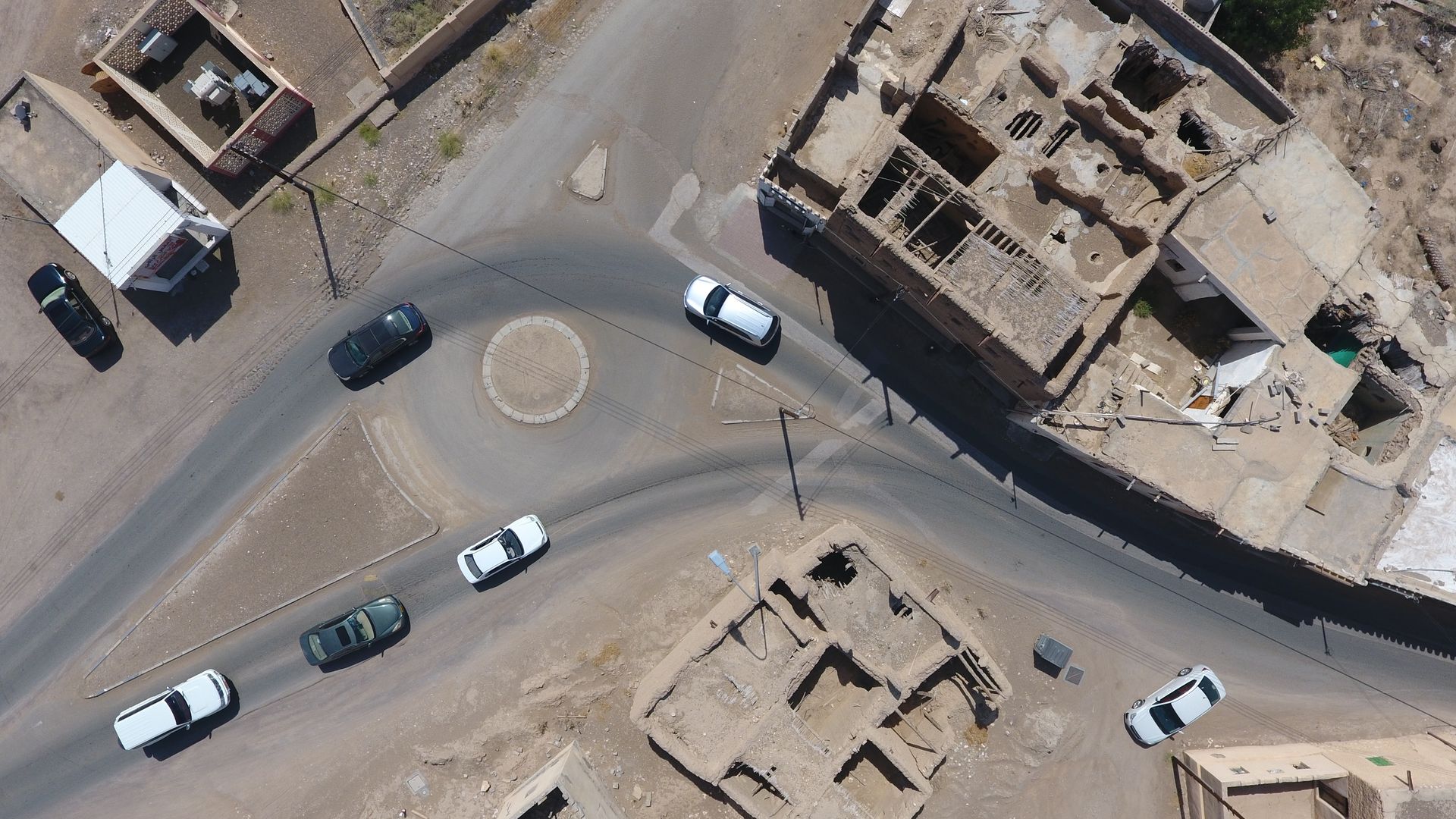
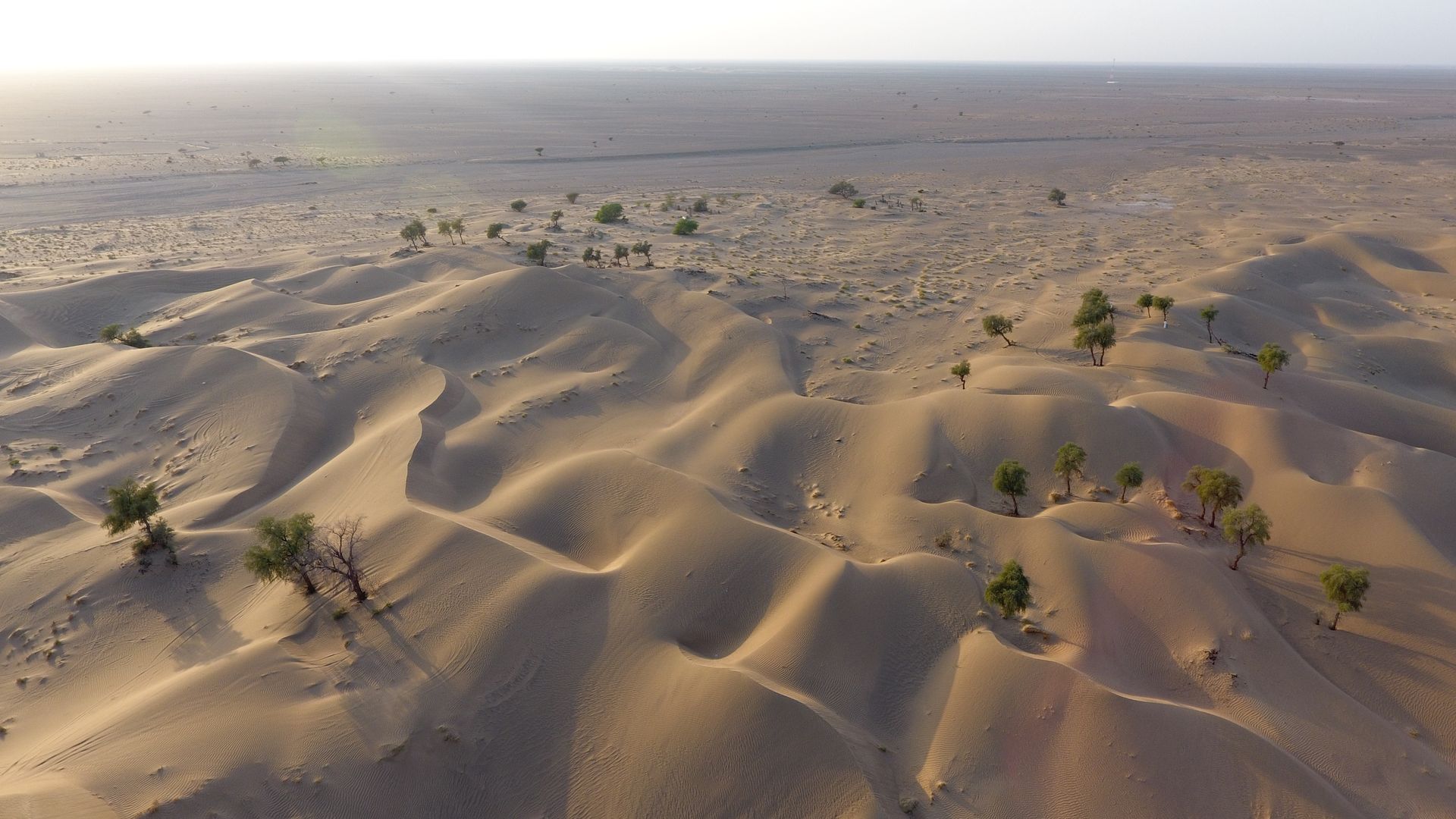
ibri | محافظة الظاهرة

ولاية عبري


ولاية عبري

ولاية عبري هي إحدى ولايات محافظة الظاهرة وتعتبر المركز الإداري لها، وقد حظيت الولاية بنصيب وافر من التنمية التي شملت جميع القطاعات خلال العهد الزاهر لحضرة صاحب الجلالة السُّلطان هيثم بن طارق المعظم -حفظه الله ورعاه- من خلال التوجيهات السامية التي ركّزت على دعم جميع المحافظات من أجل النهوض بها وتنميتها، وتوفير ما يلزم من خدمات تنموية بُغيةَ الارتقاء بالمحافظات، انطلاقًا من رؤية "عُمان 2040" التي تسعى لتطوير المجتمعات والمدن واستثمار الفرص المتاحة في مختلف القطاعات، منها التعليم والرعاية الصحية، إلى جانب تنويع واستدامة الاقتصاد.

المواقع الاثرية


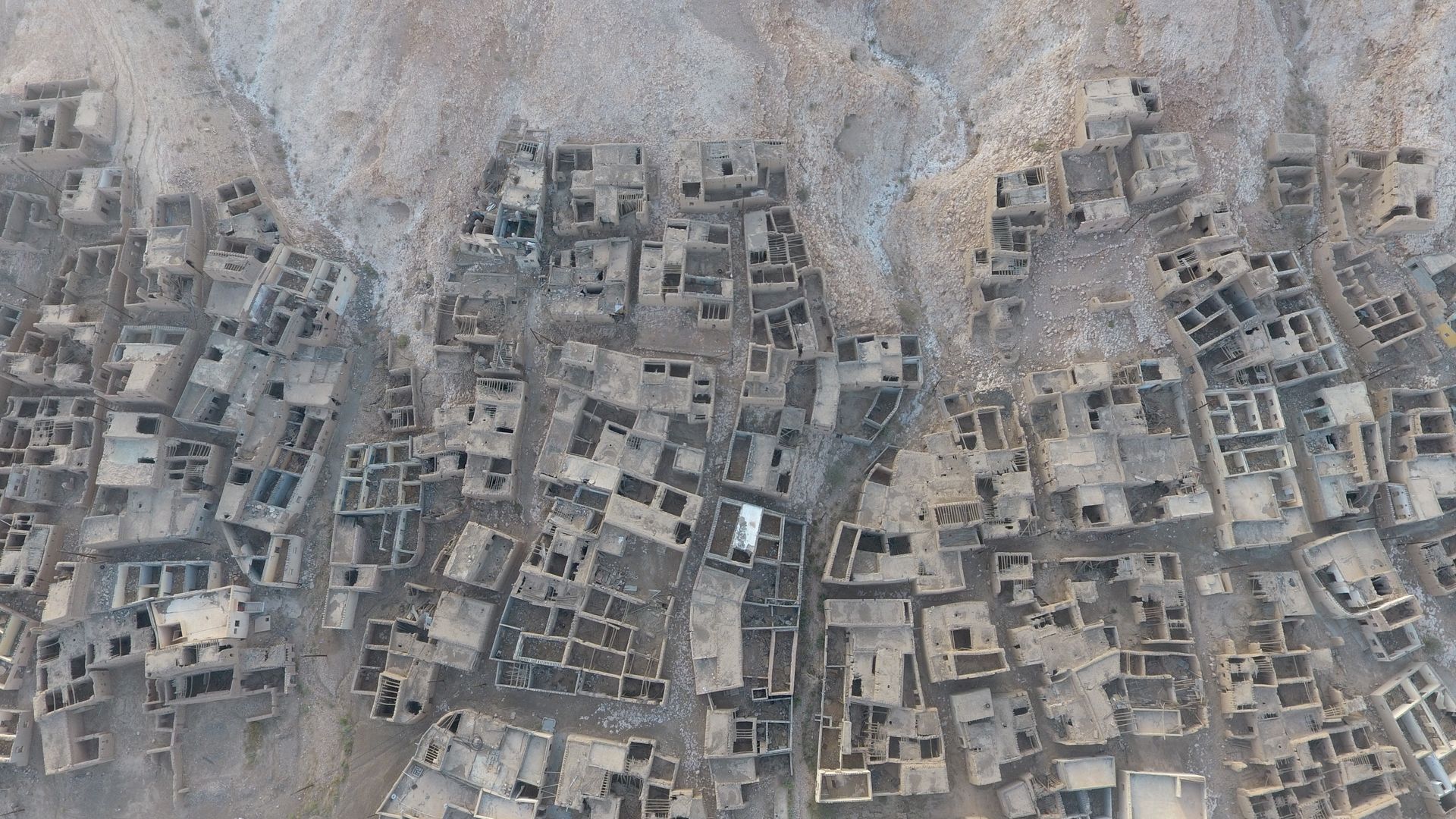
قلعة عبري – قلعة السليف وحي السليف – حارة الرمل – حصن العينين – موقع بات الأثري – قلعة العراقي – القلعة السوداء – حصن بيت المراح – حي الشعبانية – بلدة الوقبة – قلعة المناخ – حي المرقوع – قلعة البزيلي – سوق السبيخة

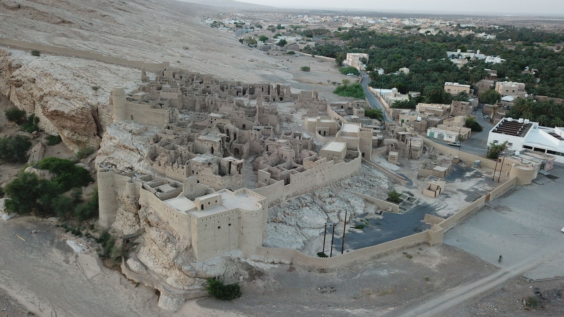
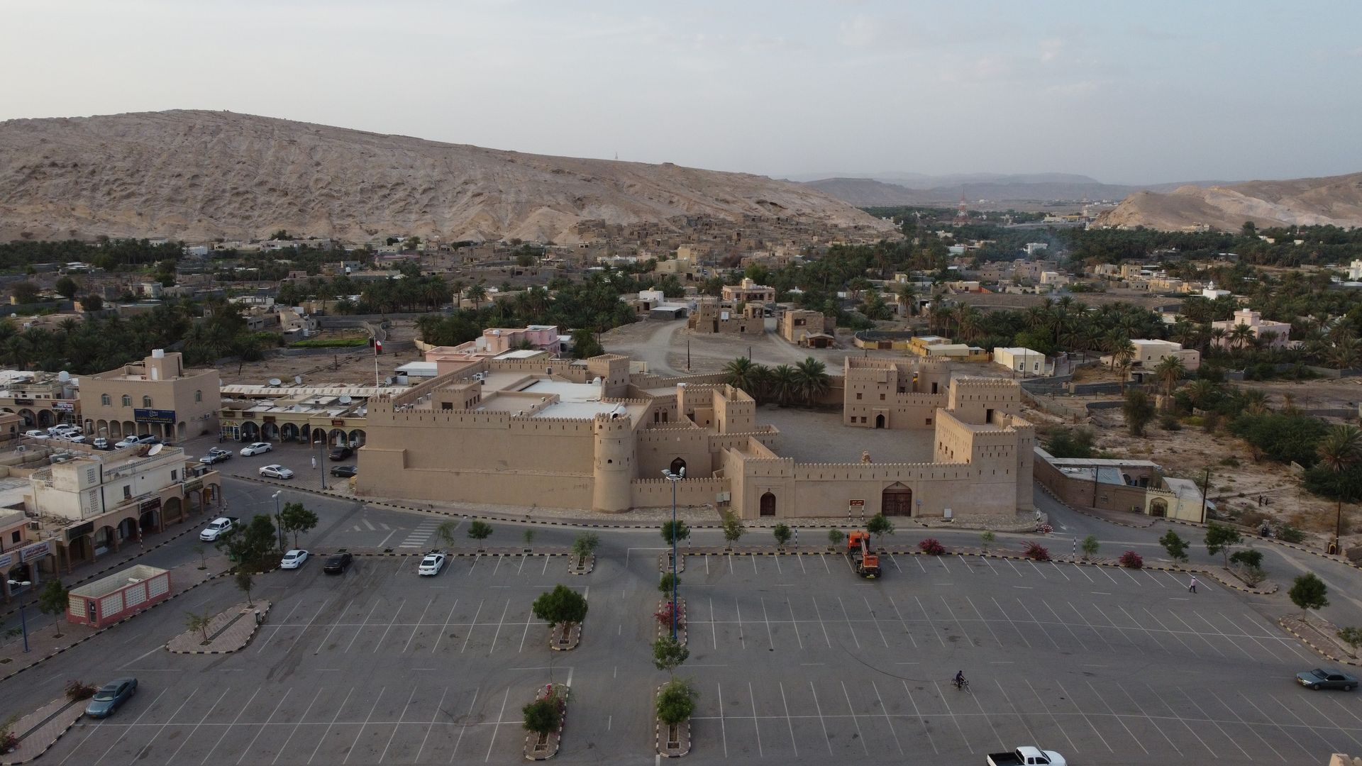
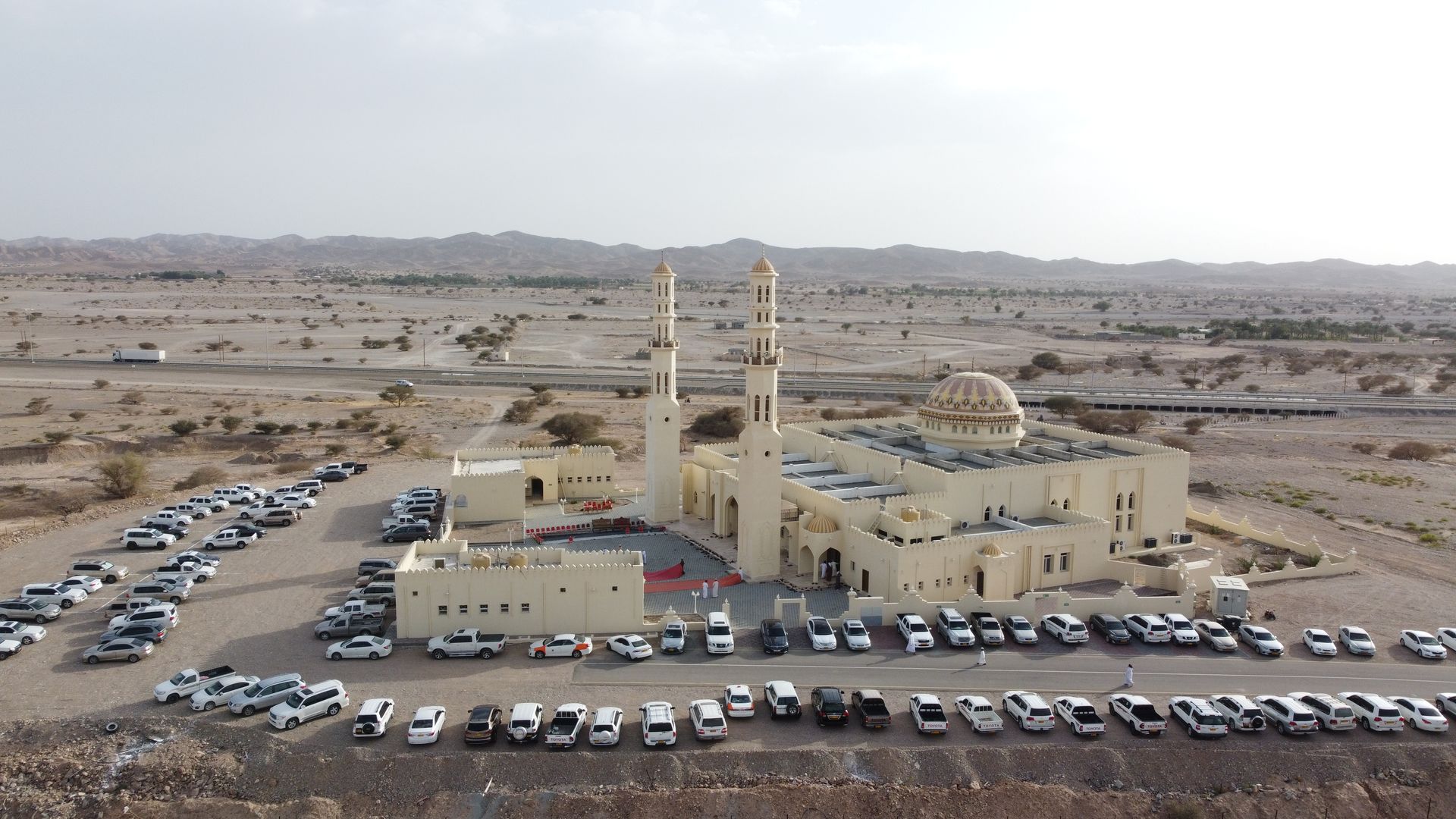
قلعة عبري وقلعة السليف

تقع قلعة عبري في مركز المدينة، بجوار السوق القديم. يعود تاريخها إلى حوالي 400 عام، أنشأها بنو نبهان وأكمل بناءها الشيخ خاطر بن عامر بن راشد اليعقوبي. تضم القلعة عدة مداخل أشهرها: صباح السنسيلا، صباح الحصن (المدخل الرئيسي)، وصباح الوسطي (المستخدم للبرزات). وتحتوي على مسجد كبير لا تزال تقام فيه صلاة الجمعة وبقية الصلوات. تشتهر القلعة بنقوشها التاريخية وآثارها العتيقة، ومنها ثلاث أبراج: الصرم، الغُرابية، وصباح السنسيلا.

أما قلعة السليف، فقد بُنيت في عهد دولة اليعاربة على يد الإمام سلطان بن سيف اليعربي عام 1718م، أي قبل 300 عام، عند سفح جبل شنبو المطل على وادي السليف. تحيط بها أسوار ضخمة وسبعة أبراج أشهرها برج الرياح. وتُعرف قرية السليف بوجود 110 منزلًا أثريًا، وسوق تراثي، وتصاميم معمارية عمانية أصيلة. تقع القرية على بعد 5 كم من مركز عبري، واشتهرت تاريخيًا بالنخيل والموارد الزراعية، وبموقعها الاستراتيجي المطل على الطرق الشرقية المؤدية إلى عبري، مما منحها أهمية دفاعية.

قرية الرمل

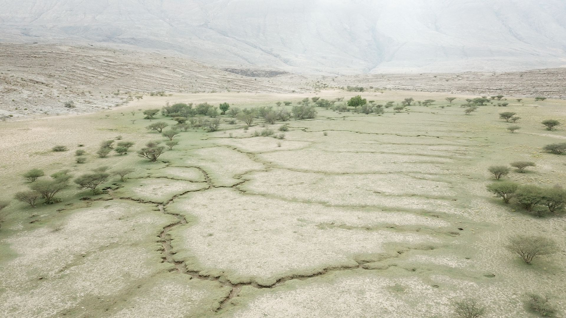
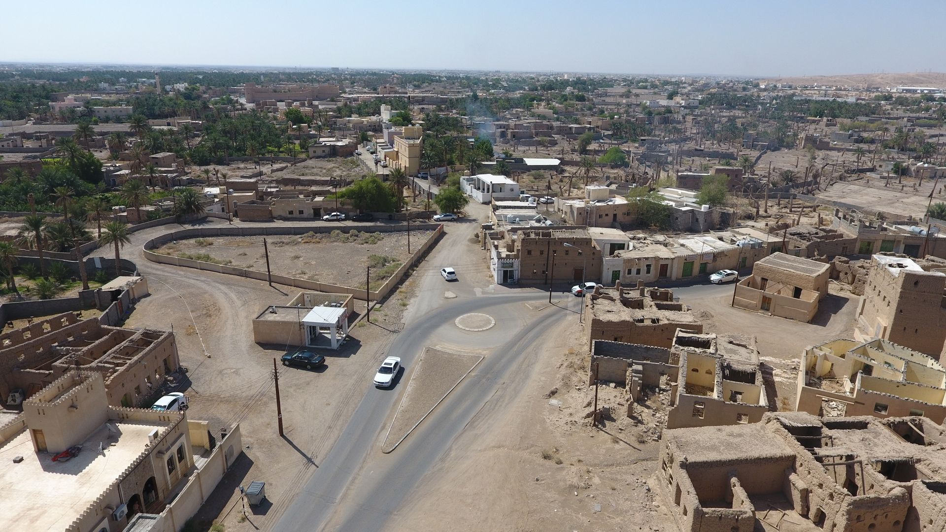
تُعد قرية الرمل موقعًا أثريًا يعود إلى أكثر من 300 عام، تقع في وسط عبري على منحدرات وجبال جبل الرمل.

حصن العينين

يقع على الطريق الرئيسي بين عبري والرستاق، وهو مثال جميل للعمارة العمانية التقليدية.

موقع بات الأثري

يقع في ولاية عبري بمحافظة الظاهرة، ويُعد موقعًا مدرجًا ضمن قائمة التراث العالمي لليونسكو، ويرجع تاريخه إلى الألف الثالث قبل الميلاد. يضم الموقع قبورًا بأسلوب أم النار في الجنوب، وقبورًا على شكل خلية نحل في الشمال، بالإضافة إلى ستة مبانٍ دائرية حجرية كبيرة، بعضها يحتوي على آبار مياه ومحاطة بخنادق مثل برج رجوم. تعود هذه المباني إلى عصر حفيت (3200–2700 ق.م)، وتضم معالم مثل برج الخاتم.

قلعة العراقي

تقع وسط بلدة العراقي، وتضم برجين وغرفًا ومستودعات وثلاثة آبار مياه. القلعة مستطيلة الشكل، مبنية من الحصى والطين والجبس و"السروچ". وتحتوي من الداخل على منازل قديمة وغرف خدم وقاعة ضيافة.

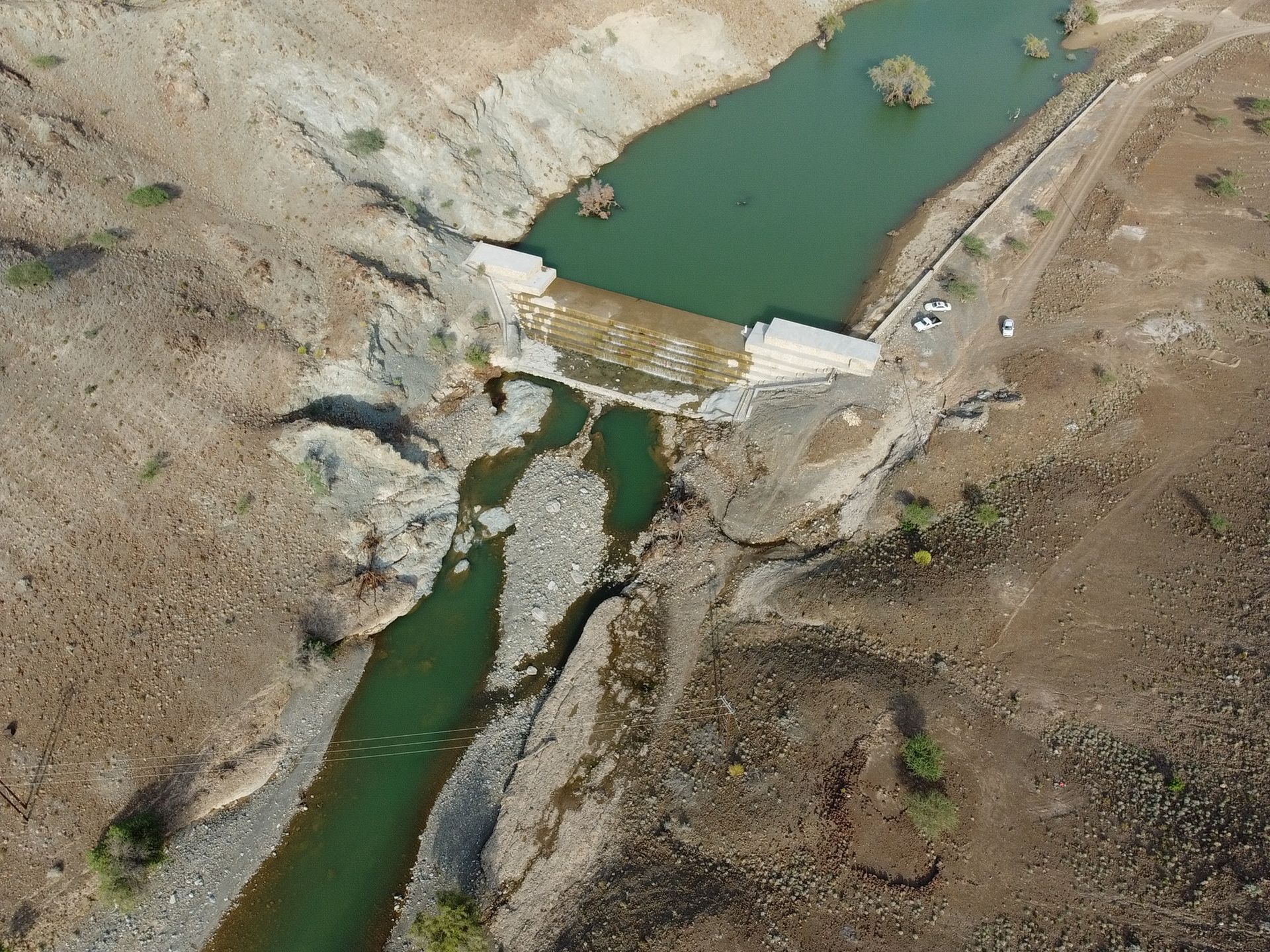
القلعة السوداء (حصن الأسود)

تقع في مقنيات، داد خصيب، على الحافة الشرقية لسهلٍ وادٍ، وبُنيت سنة 972 هـ (1564 م). تضم أربعة أبراج، وتقع على مرتفع صخري يتيح لها إطلالات استراتيجية على المناطق المحيطة.

حصن بيت المراح

يقع في قلب وادي ينقل بقرية الحصن، ويعود تاريخ بنائه إلى ما قبل الإسلام أو القرن 11 هجري (القرن 17 ميلادي). تحيط به مزارع النخيل، ويشتهر ببنائه الطيني والحجري التقليدي، وقد رممته وزارة التراث والسياحة عام 2002.

قرية الشعبانية

تعد من أكبر وأهم قرى ينقل، وتشتهر بمنازلها الطينية التقليدية المبنية بجذوع وسعف النخيل. تعرف بترابط سكانها الذين يتجمعون صباحًا لتناول القهوة العمانية.

بلدة الوقبة

تقع على بُعد 38 كم من مركز عبري، وهي بلدة جبلية ذات مناظر خلابة، تضم أودية مثل وادي بيح ووادي العريشي، مما يجعلها وجهة سياحية. وتتميز بالكهوف الجبلية، وموارد المياه، والمواقع التراثية، مع المحافظة على العمارة العمانية التقليدية.

قلعة المناخ

تقع في ولاية ضنك، وتبلغ مساحتها 1200 م²، وتضم ثلاث أبراج وعدة غرف ومستودعات. وقد رُممت بين عامي 2013 و2017، وتزوّدت بالخدمات الحديثة كالكهرباء والتكييف، مع تسهيلات لذوي الاحتياجات الخاصة.

قرية المرقوع

تقع في حي العزيزية بولاية ضنك، وتُعرف بأهميتها التاريخية والسياحية. تحدها عدة مناطق: الوسطى، العليا، المعزاء، الشكور، والوحشة.

قلعة البزيلي

تقع في قرية البزيلي بولاية ضنك، وشُيدت في عهد اليعاربة بالقرب من مجرى ماء يُعرف باسم فلج البزيلي، وهي من أبرز المعالم التاريخية المحفوظة في المنطقة.
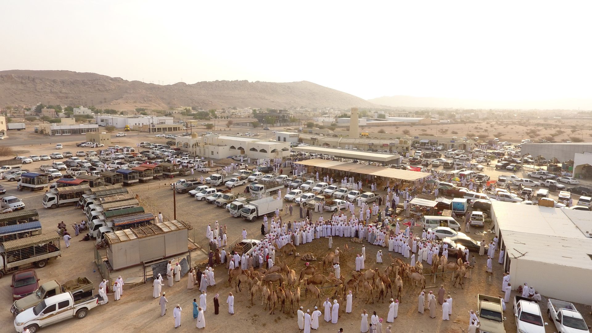
سوق السبيخة

يُعد من أقدم الأسواق التراثية التقليدية في ولاية ضنك، واشتهر بنشاطه التجاري وسط بساتين المياه، ما جعله محط أنظار التجار من مختلف المناطق. ولا يزال السوق وجهة مفضلة للزوار والسكان المحليين.


الفنون التقليدي

الفنون التقليدية

تعكس الفنون الشعبية التقليدية، مثل الرقصات والأناشيد، في ولاياتنا الهوية الثقافية لمواطني سلطنة عُمان. وتُعد هذه الفنون تجسيدًا حيًا للعادات والتقاليد، لاسيما خلال الأعياد الدينية والوطنية، وحفلات الزفاف، والمناسبات الاجتماعية الأخرى. يشارك كل من الرجال والنساء في هذه الفعاليات، والتي تنتشر بشكل واسع في ولايات عبري، ينقل، ضنك، ومنطقة حمراء الدروع. ويمارس أهالي هذه المناطق فنونًا غنية بالإيقاع والشعر، حيث يُلقي الشعراء قصائد في المديح، والغزل، والوصف، والفخر في المناسبات الوطنية والاجتماعية.


تشمل الآلات الموسيقية والإيقاعية المستخدمة في فنون محافظة الظاهرة: طبول الكاسر، الرحماني، والواقف، وهي من أبرز الأدوات التقليدية في المنطقة.


فن العيالة

هو رقصة تقليدية تُؤدى على صفين متقابلين من الرجال. يقف أفراد كل صف متقاربين، ممسكين بأيدي بعضهم، ويحيطون خصور بعضهم بالأذرع الأخرى، في دلالة على التلاحم والتعاون القبلي. وتُعزف الموسيقى بين الصفين باستخدام آلات نحاسية مثل الطبول والدفوف. ويقود الإيقاع رجل يحمل طبلة أسطوانية ذات وجهين تُسمى "الكاسر"، تضفي على الرقصة إيقاعًا نشيطًا متناغمًا مع الشعر المُلقى.


فن الميدان

يُعد من أشهر الفنون الشعبية التقليدية في سلطنة عُمان، ويشترك في أدائه سكان محافظة الظاهرة ومحافظات أخرى. يقوم على تبادل الأشعار والحوار بالكلمات بأسلوبٍ فني نابض بالحيوية، ويؤدى غالبًا في المناسبات الاجتماعية مثل حفلات الزواج، أو للترفيه، وأحيانًا لأغراض العلاج الشعبي، خاصة لمن يُعتقد أنهم تحت تأثير الجن.


فن الونّة

يُمارس هذا الفن عادةً في حلقات، حيث يجتمع الناس حول المؤدي الذي يضع راحتيه على وجنتيه ويغني بعينين مغمضتين، ثم يشاركه شخص آخر يردد البيت الأخير من النشيد بنفس الطريقة. ويتميز هذا الفن بجماله وتكراره المتناغم، ما يعكس انسجامًا عميقًا بين المغني ومرافقه.


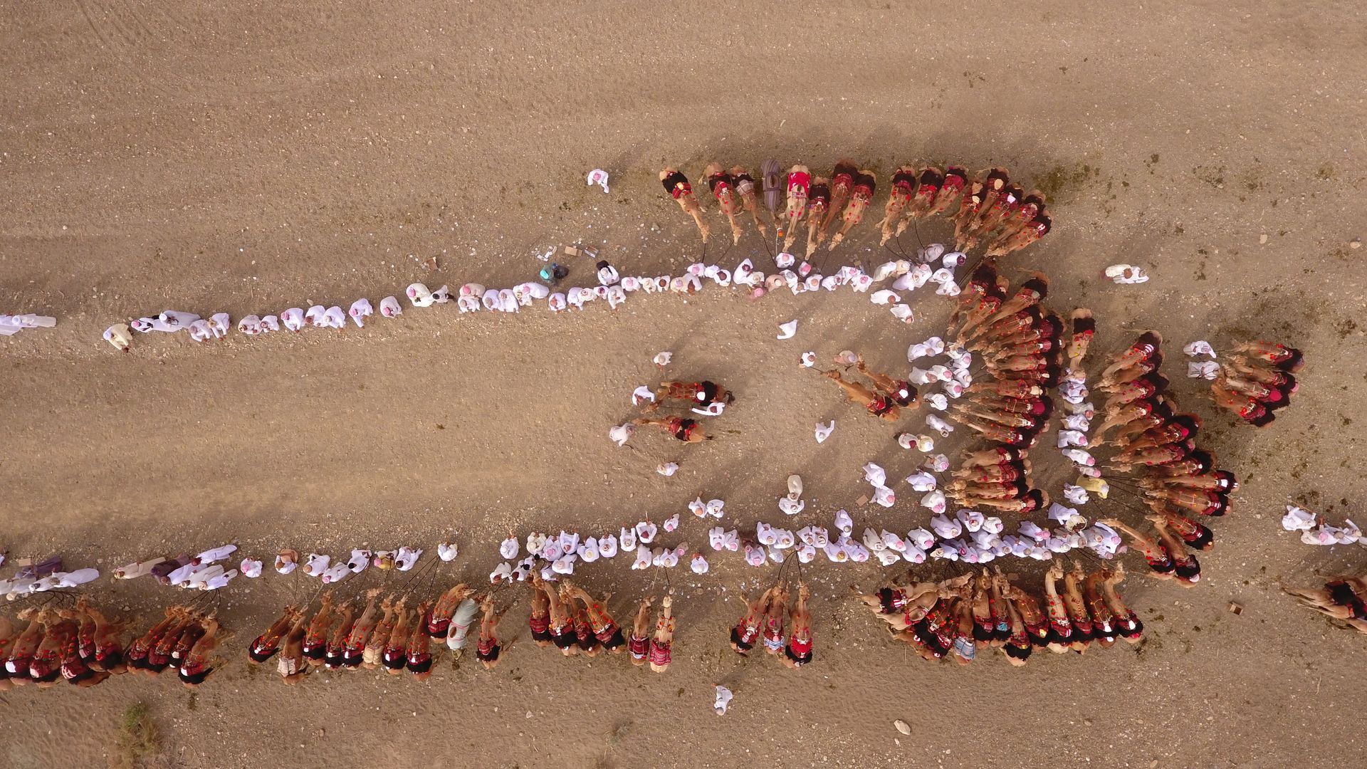
فن التغريدة (التغرودة)

التغرودة فن بدوي يُرتبط بركوب الجمال، ويُؤدى غالبًا أثناء سير الجِمال في رحلات التَخَب (الهرولة). قديمًا، كانت تؤدى كأغنية سردية في المجالس البدوية الليلية، وتُعرف أيضًا بأسماء مثل "رزحة البدو" أو "رزفة البدو". يتم الغناء بنغمة ثابتة مع مدّ الحروف، دون استخدام آلات موسيقية، وتنتشر في مختلف المناطق البدوية في السلطنة بأسماء مختلفة مثل التغرودة، التغريد، الغيرود.


رزفة البدو

فن تقليدي بدوي يُمارس في مناسبات عديدة مثل الأعراس، الختان، عيد الأضحى، عيد الفطر، والمناسبات الاجتماعية الأخرى. يختص به الرجال، حيث يصطف المشاركون في صفين متقابلين. يُلقي شاعر القصيدة على أحد الصفين فيبدأ بالغناء، ويُردده الصف الآخر بالتوازي، في نمط غنائي متناسق. ويتحرك المؤدون بين الصفين حاملين العصي أو البنادق أو السيوف، ويقومون بحركات إيمائية مثل إيماء الرأس وثني الجذع، بل وقد يُلقون بالأسلحة في الهواء ثم يلتقطونها أو يدورون بها مكونين أشكالاً جمالية.


قلعة بيت المراح

تقع في قلب وادي ينقل بقرية الحصن على الجانب الشمالي الشرقي من جبل حورا، ويحدها من الجنوب جبل الخاتم. تختلف المصادر التاريخية حول تاريخ إنشائها؛ فبينما يرى البعض أنها تعود لما قبل الإسلام، يرجح آخرون أنها بُنيت في القرن 11 هـ (القرن 17 م)، بينما يشير مصدر ثالث إلى أن منشئها هو مخزوم بن فلاح النبهاني في أوائل عهد النباهنة. شُيّدت القلعة من الطين والحجر، وقد رُممت منذ عام 2002 باستخدام مواد تقليدية مثل السروچ.


قرية الشعبانية

من أكبر وأهم القرى في ينقل، وتضم بيوتًا أثرية قديمة مبنية من الطين وسعف النخيل، وأبوابها مصنوعة من خشب السدر. لا تزال القرية تمثل رمزًا للصمود العُماني، حيث صمدت منازلها أمام الأمطار وتعاقب الزمن. ويشتهر أهالي القرية بروحهم الجماعية، حيث يجتمعون صباحًا لتناول القهوة العمانية في طقس اجتماعي متوارث.


بلدة الوقبة

تبعد 38 كم عن عبري، وتُعد من أجمل بلدات محافظة الظاهرة، محاطة بجبال شاهقة من سلسلة الحجر الغربي. تشتهر بالنشاط السياحي، وتضم أودية مثل وادي بيح ووادي العريشي التي توفر بيئة مثالية للراحة والاستجمام. كما تحتوي على بيوت تراثية مبنية بالعمارة العمانية التقليدية، وكهوف جبلية، وعيون مياه صافية تجذب هواة التسلق والاستكشاف.


قلعة المناخ

تقع بولاية ضنك، وتغطي مساحة 1200 متر مربع. تتضمن ثلاث أبراج، وبوابة رئيسية تُعرف بـ "الصباح"، وقاعة اجتماعات، وغرف ومستودعات. وقد قامت وزارة التراث والثقافة بترميم القلعة بين عامي 2013 و2017، محافظة على طابعها الأصلي باستخدام الطين والسروچ والحجر، مع تزويدها بخدمات حديثة للزوار، بما في ذلك تسهيلات لذوي الاحتياجات الخاصة.


قرية المرقوع

تقع في حي العزيزية بولاية ضنك، وتتميز بأهميتها التاريخية والسياحية. تحدها عدة بلدات هي الوسطى، العليا، المعزاء، الشكور، والوحشة.


قلعة البزيلي

تقع في قرية البزيلي بولاية ضنك، وقد بُنيت في عهد دولة اليعاربة. يمر بالقرب منها مجرى ماء يُعرف بـ فلج البزيلي، ولا تزال القلعة محفوظة كأحد أهم المعالم التاريخية في المنطقة.


سوق السبيخة

يُعد من أقدم الأسواق التراثية التقليدية في محافظة الظاهرة، ويجمع بين الطابع التاريخي والنشاط التجاري. يقع السوق وسط بساتين وجداول مياه، مما يجعله وجهة مفضلة للتجار والزوار. يُعرض فيه مجموعة واسعة من السلع مثل التوابل، القهوة، المواشي، والأسماك المجففة. وقد شهد السوق تعافيًا اقتصاديًا منذ السبعينيات، بفضل موقعه الاستراتيجي بجوار القلعة التاريخية.


Wilayat of Ibri

Ibri is considered the administrative center of Al Dhahirah Governorate. The wilayat has seen significant development across all key sectors during the reign of His Majesty Sultan Haitham bin Tarik, may Allah protect and preserve him. This progress was made possible through his royal directives, which focused on supporting all governorates in their advancement, providing essential services to foster prosperity, and aligning with the goals of Oman Vision 2040. This vision aims to develop communities and cities, capitalise on opportunities across various sectors, including education and healthcare and promote economic diversification and sustainability.

According to an old tale, the wilayat of Ibri got its name as a crossing point for commercial caravans and convoys dating back to ancient times. It is strategically located at the crossroads of trade routes, with convoys travelling from the Eastern Province to the wilayat of Nizwa and the coast, passing through Wadi Al Hawasneh.

Characterised by its distinctive geographical location on the southern slopes of the Western Hajar Mountains, descending towards the semi-desert plains, Ibri is one of the three wilayats in Al Dhahirah Governorate and a key regional centre in the Sultanate of Oman. Located 279 kilometers from the capital, Muscat, Ibri connects Oman to other regions of the Arabian Peninsula, bordering the United Arab Emirates and the Kingdom of Saudi Arabia to the west. This strategic location has made it an important commercial, economic, and cultural hub. The wilayat covers an area of approximately 45,000 km² and is bordered by several other wilayats from various governorates. To the south, it borders Haima; to the east, it borders Bahla, Adam, and Al Hamra; to the north, it borders Al Khaburah, Saham, and Yanqul; to the northeast, it borders Rustaq; and to the northwest, it borders Dhank. The wilayat includes around 244 villages and towns.​

Archaeological Sites​


Ibri Fort                 Al-Salif Castle and Al-Salif Neighborhood         Haret Al-Raml 

Husn Al Aynayn          Archaeological site of Bat                          Iraqi Fort 

Black Fortress            Husn Bait Al Marah Fort                              Shaabaniyah Quarter 

Al Wuqba town          Al Munaikh Fort                                          Al Marqoo’ Neighborhood  

Bazili Fort                  Sabikha Market


Ibri Fort and Al Sulaif Fort:

Located in the centre of Ibri, adjacent to its old market. It dates back nearly 400 years and was established by the Al-Nabahna tribe, with its construction completed by Sheikh Khater bin Amer bin Rashid Al-Yaqoubi. The fort has several entrances, the most famous being “Sabah Al Sensila,” “Sabah Al Hosn” (the main entrance), and “Sabah Al Wasati” (used for Al Barza). It also houses a large mosque where Friday prayers and other prayers are still held. The fort is known for its historical inscriptions and ancient monuments, including three towers: Al-Sarm, Al Ghorabiya, and Sabah Al Sensila.

Al Sulaif Fort and Village:

Al Sulaif Fort was built during the era of the Ya'ariba state by Imam Sultan bin Saif Al-Yarubi in 1718 AD, 300 years ago, at the foot of Mount Shanboh overlooking Wadi Al-Salif. The fort is surrounded by a massive wall and seven towers, the most famous being the wind tower. The village is known for its 110 ancient houses, archaeological market, and traditional Omani architectural designs. Al Salif village, located 5 kilometers from the center of Ibri, has historically been renowned for its palm trees and agricultural resources. The village's strategic location on a prominent cliff gave it a commanding view over the eastern roads leading to Ibri, initially serving as a defensive position.

Raml Village:

Raml village, an archaeological site built more than 300 years ago, is located in the center of Ibri on the slopes and hills of Al Raml Mount.

Al Aynayn Fort:

Located on the main road between Ibri and Rustaq, Al Aynayn Fort is a fine example of Omani architecture.

The Bat archaeological site, located in the Wilayat of Ibri, Al Dhahirah Governorate, is a UNESCO World Heritage site dating back to the third millennium BC. It includes the tombs of the Um al-Nar style in the south and beehive graves in the north. The site also features six large circular stone buildings, some with water wells and surrounded by moats, such as the Rajum Tower. These buildings date back to the Hafeet era (3200–2700 BC), with structures like the Al Khatem Tower.​

The Bat archaeological site, located in the Wilayat of Ibri, Al Dhahirah Governorate, is a UNESCO World Heritage site dating back to the third millennium BC. It includes the tombs of the Um al-Nar style in the south and beehive graves in the north. The site also features six large circular stone buildings, some with water wells and surrounded by moats, such as the Rajum Tower. These buildings date back to the Hafeet era (3200–2700 BC), with structures like the Al Khatem Tower.

Al Iraqi Fort:

Located in the center of the Iraqi town, Al Iraqi Fort features two towers, rooms, stores, and three water wells. The fort is rectangular, constructed using gravel, clay, plaster, and sarooj. Inside, there are ancient houses with service rooms and a hospitality hall.

Located in Maqniyat, Dad Khasib, on the eastern edge of a valley plain, Al Aswad Fort was built in 972 AH (1564 AD) and includes four towers. The fort, situated on a rocky outcrop, dominates the surrounding area and provides strategic views.

Located in Maqniyat, Dad Khasib, on the eastern edge of a valley plain, Al Aswad Fort was built in 972 AH (1564 AD) and includes four towers. The fort, situated on a rocky outcrop, dominates the surrounding area and provides strategic views.

Bait Al Marah Fort:

Bait Al Marah Fort, located in the heart of Wadi Yanqul in Al Hosn village, was built either before Islam or in the 11th century AH (17th century AD). Surrounded by palm plantations, the fort is known for its traditional mud and stone construction, which was restored by the Ministry of Heritage and Tourism in 2002.

Al Shaabania is one of the largest and most important villages in Yanqul, known for its traditional mud houses built with palm fronds and trunks. The village is known for its close-knit community, where people gather in the mornings to share Omani coffee.

Al Shaabania is one of the largest and most important villages in Yanqul, known for its traditional mud houses built with palm fronds and trunks. The village is known for its close-knit community, where people gather in the mornings to share Omani coffee.

Waqba Town:

Al Wuqba, located 38 kilometers from the center of Ibri, is a picturesque mountainous town with valleys like Wadi Biha and Wadi Al-Arashi, popular for tourism. The town features mountain caves, water sources, and heritage sites, making it a key tourist destination with its traditional Omani architecture.

Al Munaikh Fort:

Al Munaikh Fort in the Wilayat of Dhank is a heritage site with a total area of 1,200 square meters, featuring three towers and various rooms and stores. The fort was restored by the Ministry of Heritage and Culture between 2013 and 2017, and now includes modern amenities such as electricity and air conditioning, allowing access for people with special needs.

Al Marqua Village:

Al Marqua, located in the Al Azizi neighborhood of Dhank, is known for its historical and tourist significance. The village lies between neighboring towns and is bordered by Al Wusta, Al Alaya, Al Ma'zaa, Al Shakur, and Al Wahsha.

Bazili Fort:

Bazili Fort, located in the village of Al Bazili in Dhank, was built during the Ya'ariba era. It is situated near a water stream known as “Falj Al Bazili” and has been preserved as one of the area's significant historical landmarks.

Sabikha Market:

The ancient Sabikha market in Dhank is one of the oldest traditional heritage markets in the region. Known for its commercial activity, the market is surrounded by orchards and streams, attracting traders from various regions. It remains a popular destination for locals and visitors alike.


Traditional Arts


Traditional Arts

The traditional folk arts, such as dances and songs, in our wilayats reflect the cultural identity of Oman’s citizens. These arts are also an expressive representation of customs and traditions, particularly during religious and national holidays, weddings, and other social occasions. Both men and women actively participate in these events, which are prevalent in the wilayats of Ibri, Yanqul, Dhank, and the Hamraa Al Drooa area. The people in these areas practice extraordinary arts that are full of rhythm and poetry. Poets recite poems of praise, romance, description, and pride during national and social events. The musical and percussion instruments used in Al Dhahirah Governorate’s folk arts include the Al Kasir, Al Rahmani, and Al Waqif drums, which are the most prominent.

Art of Ayala

Ayala is a traditional dance performed by two opposite rows of men. The members of each row stand close together, holding hands and encircling each other's waist with their other arm, symbolising cohesion and tribal cooperation. In the middle of the two rows, a band plays music using a variety of musical instruments, most of which are made of copper, such as drums and tambourines. The music is led by a man holding a cylindrical drum with two faces called the "Kasir," which gives the dance a distinctive, energetic rhythm that matches the poetry recited during the performance.

Art of Al Midan

The Art of Al Midan, shared by Al Dhahirah Governorate and many other governorate in the Sultanate of Oman, is one of the most famous traditional folk arts in the Sultanate. It involves lively poetry and wordplay in Arabic, performed during social occasions such as weddings or as a form of entertainment. In some cases, it is also used for folk medicine, especially for those who believe they are under the influence of jinn.

Art of Wannah

This art is typically performed in circles, with people gathering around the singer, who places his palms on his cheeks and sings with closed eyes. Another participant joins in, repeating the last verse of the song in the same way. The art of Wannah is a beautiful, repetitive performance that showcases the harmony between the singer and their companion.

Art of Al Taghrooda

Al Taghrooda is a Bedouin art related to camel riders (bush) and their movements during the jogging (Tkhb). Historically, it was performed for storytelling during night gatherings in Bedouin councils. Also known as "Razha Al Bedouin" or "Razfa Al Bedouin," this collective singing is done in a fixed tone, with an elongation of extended letters. Performed without any percussion instruments, this art is popular throughout Bedouin regions in the Sultanate of Oman, and it has different names like Al Taghrooda, Al Taghreed, and Al Ghirud.

Al Razfa Al Badawi

Al Razfa Al Badawi is a traditional art practiced by Bedouins on various occasions, such as weddings, circumcisions, Eid al-Adha, Eid al-Fitr, and other social events. Exclusive to men, the Bedouin Razfa involves participants forming two parallel rows. A poet recites poetry to one of the rows, and this row begins to sing in rhythm with the poetry. The other row then repeats the song, creating a synchronized singing pattern. The movement in the Bedouin Razfa consists of the participants in the rows and those performing the Razfa between the rows. They may hold bamboo sticks, rifles, or swords while performing repetitive head nods and light torso bends. Some performers raise their rifles or swords in the air, throwing them up before catching them again, or they may swirl their weapons to create patterns in the air, as seen in other weapon parades.

Bait Al Marah Fort, located in the heart of Wadi Yanqul in Al Hosn village, was built either before Islam or in the 11th century AH (17th century AD). Surrounded by palm plantations, the fort is known for its traditional mud and stone construction, which was restored by the Ministry of Heritage and Tourism in 2002.​

Bait Al Marah Fort is located in the heart of Wadi Yanqul in Al-Hosn village on the northeastern side of Mount Hura, bordered to the south by Mount Khatim. Historical sources differ on its construction date, with some suggesting it was built before Islam, others indicating the 11th century AH (17th century AD), while a third source claims it was built by Makhzoum bin Falah Al Nabhani during the early era of the Nabahna. Constructed with mud and stone, the fort has undergone restoration since 2002 using traditional materials like Sarooj.

Al Shaabania Village

Al Shaabania is one of the largest and most important villages in Yanqul. It consists of old archaeological houses made of mud and palm fronds, with doors crafted from the Sidr tree. The village remains a symbol of Omani resilience, with homes that have withstood rain and the passage of time. The village is known for its strong community spirit, where people gather in the morning to share Omani coffee, a tradition passed down through generations.

Waqba Town

Located 38 kilometers from Ibri, Waqba Town is one of the most beautiful towns in Al Dhahirah Governorate, surrounded by towering mountains within the Western Hajar range. Waqba is renowned for its active tourism, with valleys like Wadi Biha and Wadi Al-Arashi offering relaxing spots for rest and recreation. The town is also home to several heritage sites, including ancient houses with traditional Omani architecture. Its mountain caves and clear water sources attract hiking and climbing enthusiasts.

Munaikh Fort

Al Munaikh Fort, located in Dhank, is a heritage site covering an area of 1,200 square meters. It features three towers, a main gate called “Sabah,” a general assembly hall, rooms, and stores. The fort was restored by the Ministry of Heritage and Culture between 2013 and 2017, maintaining its original construction style using clay, sarooj, and stone while adding modern amenities for visitors, including accessibility for people with special needs.

Al Marqua Village

Al Marqua, located in the Al Azizi neighborhood of Dhank, is known for its historical and tourist significance. The village lies between neighboring towns and is bordered by towns such as Al Wusta, Al Alaya, Al Ma'zaa, Al Shakur, and Al Wahsha.

Bazili Fort

Located in the village of Al Bazili in Dhank, Bazili Fort was built during the Ya'ariba era. A water stream, “Falj Al Bazili,” runs through the site, and the fort remains a significant historical monument.

The ancient Sabikha market in Dhank is one of the oldest traditional heritage markets in the region. Known for its commercial activity, the market is surrounded by orchards and streams, attracting traders from various regions. It remains a popular destination for locals and visitors alike.

The Sabikha market in Dhank is one of the oldest traditional heritage markets in the governorate. Combining history and commercial activity, the market is surrounded by orchards and streams, attracting traders and visitors alike. It remains a popular destination for locals, showcasing a wide range of goods, including spices, coffee, livestock, and dried fish. The market has seen a steady economic recovery since the 1970s, due to its strategic location next to the historical fort.